Sprowston vs Thorpe St Andrew: two north-east Norwich suburbs compared
A semi costs the same in both: £280,000 in Sprowston and £282,250 in Thorpe St Andrew. The choice is which side of Norwich your life runs on, the Northway and airport or the Yare and the station.

A semi-detached house costs the same in Sprowston and Thorpe St Andrew. In the year to June 2026 the median semi sold for £280,000 in Sprowston and £282,250 in Thorpe St Andrew (HM Land Registry). Both suburbs have a secondary school with a sixth form, and neither has a station. The choice comes down to which side of Norwich your life runs on: Sprowston faces the Broadland Northway and the airport, Thorpe faces the River Yare and the railway station.
Side by side
| Factor | Sprowston | Thorpe St Andrew |
|---|---|---|
| Median sold price, 12 months to June 2026 | £280,000 (200 sales, NR7 8) | £300,000 (209 sales, NR7 0) |
| Band D council tax, 2026-27 | £2,466.51 | £2,449.89 |
| Population, 2021 Census | 17,126 | 14,521 |
| Secondary school | Sprowston Community Academy, 11 to 18: expected standard in all seven areas (May 2026) | Thorpe St Andrew School and Sixth Form, 11 to 18: Good in every area (April 2025) |
| Main bus to the city | Pink Line 11 and 12, together about every 15 minutes, about 25 minutes to Castle Meadow | Green Line 14, 14A, 15 and 15A, about 11 minutes to Castle Meadow via the station |
| Weekly shop | Tesco Extra and Lidl, Blue Boar Lane | Sainsbury’s superstore, Pound Lane |
| Open space | Mousehold Heath, 184 acres | The Yare, with Whitlingham Country Park on the far bank |
Prices: level, except at the top
HM Land Registry recorded 200 standard sales in Sprowston’s NR7 8 postcode sector and 209 in Thorpe’s NR7 0 sector in the 12 months to June 2026. The medians were £280,000 and £300,000. Semis, the most common type in both, were level. Terraced houses were slightly dearer in Sprowston, at £235,500 against £231,000.
The £20,000 gap in the overall median comes from Thorpe’s detached houses and its top end. Detached houses there had a median of £370,000, against £343,750 in Sprowston. Five houses in Thorpe’s sector sold for £600,000 or more, the dearest a detached house on Yarmouth Road at £950,000; the others were on Thorpe Hall Close, Hilly Plantation, Hillside Avenue and Boulderside Close. Six houses on Thunder Lane went for between £332,500 and £552,500. None of Thorpe’s 209 sales was a new build.
Sprowston is where the new houses are. Beeston Park, planned at about 3,500 homes, runs across the northern edge from Wroxham Road to Buxton Road in Old Catton, and Barratt David Wilson Homes is building its Phase 3a of 319 homes. Buyers on the northern side should expect construction traffic on Wroxham Road and North Walsham Road for years.
Median sold prices by type, 12 months to June 2026
Bar widths scaled to the highest figure. Source: HM Land Registry Price Paid Data, standard sales at Broadland addresses in NR7 8 (Sprowston) and NR7 0 (Thorpe St Andrew), 1 July 2025 to 30 June 2026.
Council tax is almost the same. Both are Broadland parishes, and Band D for 2026-27 is £2,466.51 in Sprowston and £2,449.89 in Thorpe. The difference is the town council precept: £143.43 at Band D in Sprowston and £126.81 in Thorpe.
Still deciding where in Norfolk?
Get the free Norfolk Relocation Pack: all 46 towns we cover on one table, on price, council tax, population, trains and distance to Norwich, plus a week-by-week move checklist. The download appears here as soon as you enter your email.
Unsubscribe any time.
Schools
Both suburbs keep children from 11 to 18. Thorpe St Andrew School and Sixth Form, on Laundry Lane, has 1,830 pupils. Ofsted graded it Good in every area, sixth form included, in April 2025, up from Requires Improvement in 2022. Sprowston Community Academy, on Cannerby Lane, has 1,702. It was inspected in May 2026 under the new report cards, which give no overall grade, and was at the expected standard in all seven areas. The report found GCSE results broadly in line with national averages and A-level results below them.
Neither school filled its Year 7 in May 2026, according to Norfolk County Council’s Schoolfinder: Thorpe had 269 pupils against 300 places and Sprowston 306 against 330. Admissions priority still goes by the area each school serves, so check an address with the county council before you pay for it.
At primary level, Sprowston Infant and Junior Schools on Recreation Ground Road are both rated Good. White Woman Lane Junior School, one of the academy’s feeder schools, was rated Outstanding in 2018 and kept that grade at an inspection in May 2024. In Thorpe, Dussindale and St William’s primaries kept their Good ratings in spring 2025, and Hillside Avenue was rated Good in every area in 2022.
Getting into Norwich
From Sprowston, First’s Pink Line 11 and 12 run along Wroxham Road, each about every half hour, and take about 25 minutes from the Tesco stop to Castle Meadow; the 12 goes on to the Norfolk and Norwich University Hospital. By car the city centre is 10 to 15 minutes off-peak via Wroxham Road. The Broadland Northway, along Sprowston’s northern edge, reaches the airport and the A47 without crossing the city. Cycling into the centre is a flat 3 to 4 miles.
Thorpe is two miles from the city centre on Yarmouth Road. First’s Green Line 14 and 14A run every 30 minutes and the 15 and 15A hourly, and from River Green they reach Castle Meadow in about 11 minutes, passing Norwich station on the way. The Red Line 24 runs about every 20 minutes from the Sainsbury’s on Pound Lane. Off-peak the drive in takes 8 to 12 minutes; Yarmouth Road is slow at peak times. The A47 is about 10 minutes away.
For London, Thorpe is the easier start. From Norwich station, the fastest train to Liverpool Street takes 1 hour 39 minutes and most about 1 hour 50. From Sprowston the station is 15 to 20 minutes by car.
Shops, doctors and the river
Sprowston’s weekly shop is on Blue Boar Lane, where the Tesco Extra and Lidl stand side by side, and there is an Aldi at 463 Sprowston Road. The East Norwich Medical Partnership runs the Sprowston Primary Care Centre on Aslake Close. Mousehold Heath, 184 acres of heath and woodland, lies between Sprowston and the city, and Sprowston Manor on Wroxham Road has a par-71 golf course. There is no high street.
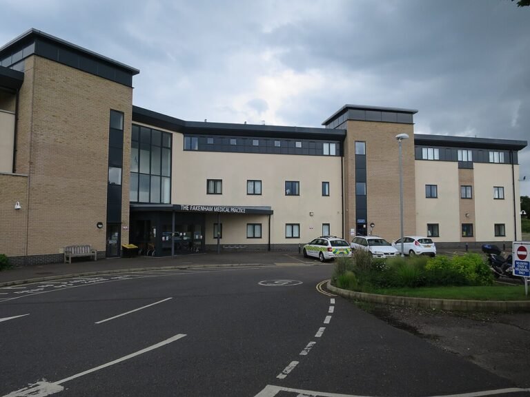
Thorpe has a Sainsbury’s superstore on Pound Lane, open since 1989, and post offices at 158 Yarmouth Road and 142 Thunder Lane. The same medical partnership runs Thorpe Health Centre on St Williams Way, and Thorpewood Medical Group is on Woodside Road. Two pubs on Yarmouth Road, the Rivergarden and the Town House, have gardens running down to the Yare. The Buck, at number 55, closed in July 2019.
The river is what Thorpe has and Sprowston does not. River Green has free moorings for visiting boats. Whitlingham Country Park is on the opposite bank, reached by road through Trowse, with two broads, a level 2.3-mile trail round the Great Broad, and boat hire, sailing and paddleboarding through Whitlingham Adventure. Houses on the river side of Yarmouth Road back onto the Yare, so check the Environment Agency’s flood map for the exact address before you offer.
Verdict
Buy in Sprowston if you want a new-build house, work on the north side of the city or at the airport, and want a bus every quarter of an hour. A semi costs the same as in Thorpe; the newer homes and the north-side location are the reasons to choose it.
Buy in Thorpe St Andrew if you want the river, an older house, or quick access to Norwich station for London. It costs more only if you want a detached house or one of the few big houses above the Yare; in the year to June 2026 only five sold for £600,000 or more.
Plan the move
How we produced this guide
Both suburbs are in Broadland District, so district services and planning policy are the same for either address; only the town council precept differs. Sale prices are HM Land Registry Price Paid Data for standard sales at Broadland addresses in the NR7 8 (Sprowston) and NR7 0 (Thorpe St Andrew) postcode sectors, 1 July 2025 to 30 June 2026. Thorpe streets with NR7 9 postcodes, on the north side, are not included. Population is from the 2021 Census. School details are from Ofsted reports, the Department for Education register and Norfolk County Council’s Schoolfinder. Bus times are from the First timetables on bustimes.org, checked on 24 September 2026, and the London journey time is Greater Anglia’s published average. Council tax is from Broadland District Council’s 2026-27 charges. Drive times are typical times on the main roads. We update this guide quarterly. See our methodology page for source links, and our Holt vs Aylsham and Norfolk vs Suffolk pages for other comparisons.
Frequently asked questions
Which is cheaper, Sprowston or Thorpe St Andrew?
Sprowston, slightly. Its median sale in the year to June 2026 was £280,000 against £300,000 in Thorpe. Semis cost the same in both; the gap is in detached houses, which had medians of £343,750 and £370,000.
Neither has a station. How does the Norwich commute work?
By bus or car. Sprowston’s Pink Line buses run about every 15 minutes and take about 25 minutes to Castle Meadow. Thorpe’s Green Line buses take about 11 minutes and stop at Norwich station on the way.
Which has the better schools?
Both secondaries take pupils to 18. Thorpe St Andrew School was graded Good in every area in April 2025, and Sprowston Community Academy was at the expected standard in all seven areas in May 2026. White Woman Lane Junior, which feeds the Sprowston academy, is rated Outstanding.
Which is better for getting to the Broads?
Thorpe St Andrew. It is on the River Yare, River Green has free moorings for visiting boats, and Whitlingham Country Park is across the water, reached by road through Trowse.
Who should pick Sprowston?
Buyers who want a newer house, a bus every 15 minutes and quick access to the Broadland Northway and the airport. Semis cost the same as in Thorpe, so the reasons to pick it are the location and the newer houses.
Data sources: HM Land Registry, ONS Census 2021, Ofsted, Norfolk County Council, Broadland District Council, bustimes.org, Greater Anglia, Whitlingham Country Park. Sales for the 12 months to June 2026. Last updated: 24 September 2026. Author: Tom Fletcher, Property and Transport Editor.
Last reviewed
Want the raw numbers side by side? Run Sprowston and Thorpe St Andrew through the data tool, or answer five quick questions for a shortlist across all 46 places we cover.
Planning a move to Norfolk?
Our guides to hiring the firms a move needs.
We earn no commission on these links. Paid placements are sold separately and always labelled. See our advertising and disclosure page.