All area guides
Living in Poringland
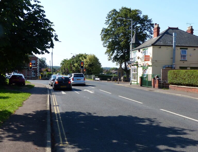
Poringland is a fast-growing village five miles south of Norwich. Most families buy here for the schools and the bus into the city, and prices match Hethersett.

Poringland is a village five miles south of Norwich on the B1332 Bungay road, and it has grown fast: from 3,802 residents in 2011 to about 5,500 in 2021. Most families buy here for the school run. The primary is rated Good, Framingham Earl High is under a mile up the road, and the Charcoal Line bus reaches the city centre in about 20 minutes.
Where it is: about 5 miles south-east of Norwich city centre as the crow flies, in South Norfolk district, postcode NR14.
Buy in Poringland for the schools and a short run into Norwich from the south. Do not buy it expecting a bargain.
Prices here match Hethersett: the median sale in both was about £305,000 in the year to June 2026. What you get for the money is a Good primary in the village, a secondary school within walking distance and at least two buses an hour to the city in the day. Look elsewhere if you need a railway station, want a period house, or want a market town you can walk round. Poringland is a large village of mostly post-war housing.
House prices
HM Land Registry recorded 99 standard sales in Poringland in the 12 months to June 2026. The median was £305,000. Detached houses had a median of £385,500 (48 sales), semis £293,000 (26), terraced houses £263,750 (20) and flats £140,000 (5). The latest months are still being registered, so the counts will rise.
That is no discount on the villages west of the city. Hethersett had a median of £304,250 across 134 sales over the same period, and Mulbarton £312,500 across 52. Our Costessey guide covers another choice on the western side of the city.
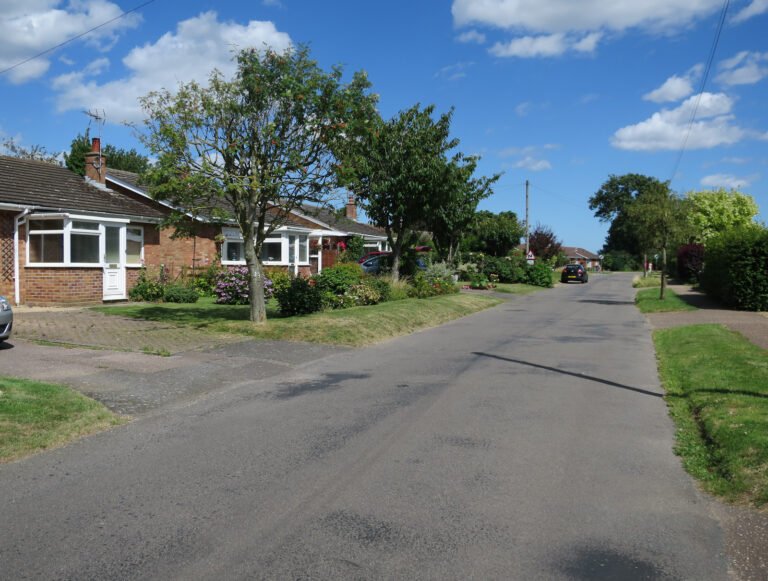
Most of the housing was built from the 1950s to the 1980s, with a run of bungalows along Stoke Road and Shotesham Road and a few Victorian and interwar cottages on The Street and Stoke Road. Newer estates off Overtons Way and towards Framingham Earl account for the rest.
| Property type | Poringland median, 12 months to June 2026 | Sales | South Norfolk average, July 2026 |
|---|---|---|---|
| Detached | £385,500 | 48 | £428,324 |
| Semi-detached | £293,000 | 26 | £276,178 |
| Terraced | £263,750 | 20 | £229,757 |
| Flat | £140,000 | 5 | £133,971 |
The district column comes from the UK House Price Index, which put the South Norfolk average at £311,587 in July 2026, up 1.5% on a year earlier. The index is adjusted for the mix of homes sold, so it does not compare exactly with the simple Poringland medians.
Poringland and Framingham Earl run into each other along the B1332 and are in the same district ward, Poringland with the Framinghams, so search both. The council tax is lower on the Framingham Earl side: Band D there is £2,400.77 for 2026-27, against £2,523.50 in Poringland, a difference of £122.73 a year.
Schools
Poringland Primary School is on The Footpath (NR14 7RF, URN 120841). Ofsted inspected it on 23 May 2023 and rated it Good; the report was published on 7 July 2023.
Framingham Earl High School is on Norwich Road in Framingham Earl (NR14 7QP, URN 145776), under a mile north of the primary, towards Norwich. It takes pupils aged 11 to 16 and had 791 on roll against a capacity of 810. Ofsted inspected it on 18 October 2022 and rated it Good (report published 5 December 2022). From Poringland it is a 15 to 20 minute walk, depending on where you start.
Neither school goes beyond 16. Sixth-formers travel into Norwich, to the sixth form colleges or City College, by bus. Wymondham College, the state boarding school, was rated Outstanding in a report published in December 2023. For independent schools, our guide to private schools south of Norwich compares Town Close, Norwich School and Langley from Poringland.
Thinking about moving to Poringland?
Get the free Norfolk Relocation Pack: Poringland and the other 45 towns we cover on one table, on price, council tax, population, trains and distance to Norwich, plus a week-by-week move checklist. The download appears here as soon as you enter your email.
Unsubscribe any time.
Getting around
The bus is First Eastern Counties’ Charcoal Line: services 40, 40A, 41, 41A and X41 between Poringland and St Stephens Street in Norwich. On weekdays there are two or three buses an hour through the day, and the ride from the church to St Stephens Street takes about 20 minutes. Evenings are hourly or so, and the last bus out of Norwich on a weekday leaves at 23:10. On Sundays the 41A and X41 alternate, roughly once an hour, with the last bus out of the city at 17:20. The 41 group carries on south to Bungay and Halesworth.
Other routes: Central Connect’s 64 runs between Norwich and Harleston, Our Bus runs the 86 between Beccles, Loddon and Norwich, and Sanders runs the 841 between Kirstead Green and Framingham Earl.
By car, Norwich city centre is 15 to 20 minutes off-peak up the B1332. The road is slow at the school run, and on Friday afternoons when traffic heads south towards Bungay and the coast. The A146 to Loddon and Lowestoft is about two miles east, and the A47 southern bypass is within 10 minutes, for the A11 to Cambridge and London and the A140 to Diss and Ipswich.
There is no railway station. Norwich station, 15 to 20 minutes by car, has Greater Anglia trains to London Liverpool Street, the fastest in 1 hour 39 minutes and most in about 1 hour 50. Cyclists can avoid the B1332 by using the lanes through Stoke Holy Cross and Arminghall.
In the village
The shops are strung along The Street. There is a Tesco Express, a Well pharmacy at 16 to 18, the Fresh Bread Micro Bakery at 16A, and a run of takeaways and cafes around numbers 107 to 119, including Win Lee, Kairali and Zaks diner. Premier Express is on Shotesham Road. For a bigger shop, the retail park at Harford Bridge on the A140 is about 10 minutes away.
The Post Office is an outreach counter at The Octagon, All Saints Church, open on Fridays from 09:30 to 11:30 only. All Saints is one of Norfolk’s round-tower churches.
There are two pubs: the Poringland Oak at 44 The Street, called the Royal Oak until 2020, and the Dove Inn on Bungay Road.
There are two GP practices. Heathgate Medical Practice is on The Street, and Old Mill and Millgates Medical Practice gives its address as Hardley Road, Poringland. The Norfolk and Norwich University Hospital is about 15 minutes away.
Poringland Library and the Community Centre, which has a cafe, are side by side on Overtons Way, next to the playing fields. Footpaths lead south and west into the Tas Valley towards Stoke Holy Cross and Shotesham.
Broadband
We do not have a Poringland-only figure. Across South Norfolk, thinkbroadband’s September 2026 data shows 77.3% of premises can get full fibre and 97.52% can get 30 Mbps or more. Check the exact address on Ofcom’s broadband checker before you buy.
Plan the move
How we produced this guide
Poringland, Hethersett and Mulbarton sale prices are from HM Land Registry Price Paid Data, standard sales only, for the 12 months to June 2026. South Norfolk figures are from the UK House Price Index, July 2026. Population is from the 2011 and 2021 Censuses. School details are from Ofsted reports, checked on 24 September 2026. Bus times are from the timetables on bustimes.org, checked on the same day. Shops and cafes were checked against the Food Standards Agency’s register of food businesses, the Post Office against the Post Office branch finder, and the GP practices against the NHS website. Council tax is from South Norfolk Council’s 2026-27 charges. Drive times are typical times on the main roads. Broadband figures are from thinkbroadband. We update this guide quarterly. See our methodology page for source links.
Frequently asked questions
Is Poringland a nice place to live?
For families it works well: the primary is rated Good, the secondary is under a mile away and buses to Norwich run two or three times an hour in the day. It is not cheap for the area, the Post Office opens only on Friday mornings, and there is no railway station.
What is the average house price in Poringland?
The median of the 99 standard sales HM Land Registry recorded in the 12 months to June 2026 was £305,000. Semis had a median of £293,000 and detached houses £385,500.
How far is Poringland from Norwich?
About five miles south of the city centre on the B1332. The drive takes 15 to 20 minutes off-peak and the bus about 20 minutes.
Which bus goes from Poringland to Norwich?
First Eastern Counties’ Charcoal Line: the 40, 40A, 41, 41A and X41, which run to St Stephens Street two or three times an hour on weekday daytimes and about hourly on Sundays. The last weekday bus back from Norwich leaves at 23:10.
What are the schools like in Poringland?
Poringland Primary School was rated Good by Ofsted after an inspection on 23 May 2023. Framingham Earl High School, for ages 11 to 16 and under a mile north, was rated Good on 18 October 2022. Neither has a sixth form.
Is there a train station in Poringland?
How does Poringland compare with Mulbarton and Framingham Earl?
Framingham Earl runs into Poringland, shares its schools and bus, and has a lower council tax: £2,400.77 at Band D against £2,523.50. Mulbarton’s median sale price was £312,500 in the year to June 2026, a little above Poringland’s £305,000. See our Mulbarton guide.
How big is Poringland?
About 5,500 people lived in the parish at the 2021 Census, up from 3,802 in 2011. It is in South Norfolk district.
Related guides
Sources: HM Land Registry, Ofsted, bus timetables, South Norfolk Council and the Census. Prices to June 2026 (sales) and July 2026 (district index); Ofsted reports checked 24 September 2026. Author: James Ward, Money and Property Finance Editor.
Last reviewed
Still weighing it up? See how Poringland compares with Mulbarton on prices, schools, broadband and council tax, or answer five quick questions and get a shortlist of the Norfolk towns that fit you.
Planning a move to Norfolk?
Our guides to hiring the firms a move needs.
We earn no commission on these links. Paid placements are sold separately and always labelled. See our advertising and disclosure page.