All area guides
Living in Hellesdon
Hellesdon is where a lot of Norwich families buy their semi. Buses along Drayton High Road leave for the city centre about every 15 minutes; there is no station or village centre.

Hellesdon is where a lot of Norwich families buy their semi. More than half of the 152 homes sold in the suburb in the year to June 2026 were semi-detached, at a median of £275,000, and buses along Drayton High Road leave for the city centre about every 15 minutes. It has no railway station and no village centre, and it does not try to have either.
Where it is: about 3 miles north-west of Norwich city centre as the crow flies, in Broadland district, postcode NR6.
Buy in Hellesdon if you want a family house with a garden inside the Norwich bus network, and you are not looking for a village.
It suits families who want a primary school within walking distance, people who work in the city or at the airport, and buyers who would rather spend their budget on a bigger house than a better postcode. It does not suit anyone after period houses, a centre with independent shops, or a station. Parents of secondary-age children should read the Hellesdon High School report before they buy.
The suburb
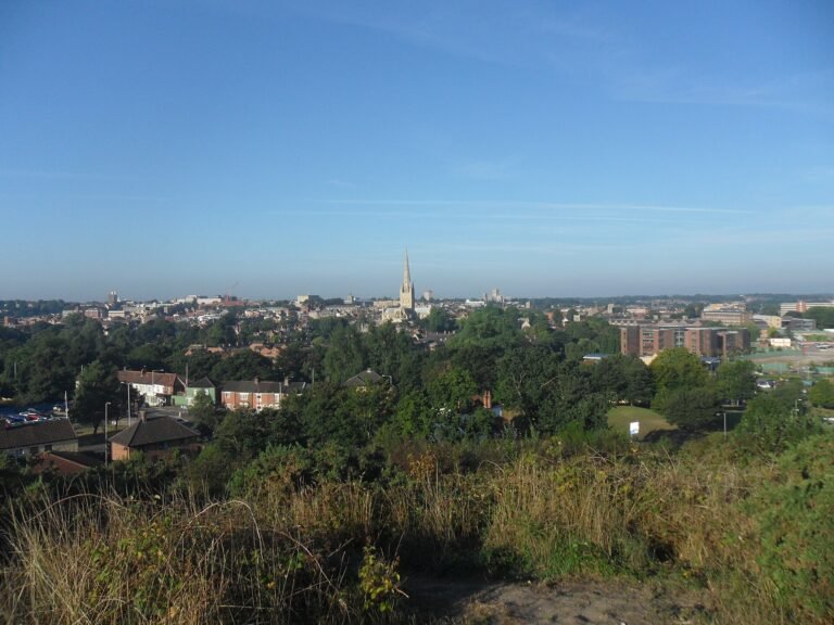
Hellesdon is a civil parish in Broadland district, on the north-west edge of Norwich, with the River Wensum along its southern side. It had 11,126 residents at the 2021 Census. It is a settled area: none of the 152 sales Land Registry recorded here in the year to June 2026 was a new build.
The shops are spread out, with no centre. The Asda superstore on Drayton High Road has a pharmacy and a filling station, B&Q is on Boundary Road, and the old Firs pub is now a Tesco Express. The Whiffler and The Bull are the two pubs still open; The Bull got its name back in 2022. St Mary’s Church on Low Road is mostly 15th century.
The GP practice is Hellesdon Medical Practice at 343 Reepham Road, which its NHS listing showed as accepting new patients when we checked in September 2026. Hellesdon Hospital, a mental-health hospital, is on the western side of the parish off Drayton High Road, and the East of England Ambulance Service has its Norwich base beside it.
House prices
HM Land Registry recorded 152 standard sales at Broadland addresses in the NR6 5 and NR6 6 postcode sectors, the two that cover Hellesdon, in the 12 months to June 2026. The median price was £275,000 and the mean £284,000. Semis made up 82 of those sales.
| Property type | Sales | Median price |
|---|---|---|
| Detached | 45 | £325,000 |
| Semi-detached | 82 | £275,000 |
| Terraced | 13 | £250,000 |
| Flats | 12 | £145,000 |
| All standard sales | 152 | £275,000 |
Hellesdon is not cheaper than Norwich overall. The UK House Price Index put the Norwich City average at £224,323 in July 2026, pulled down by the number of flats in the city, against £313,407 for Broadland as a whole. Where Hellesdon does undercut the city is on semis: the index gives £287,637 for the average semi in Norwich. The index is adjusted for the mix of homes sold, so treat that as a guide, not a like-for-like comparison with the Hellesdon medians.
Thinking about moving to Hellesdon?
Get the free Norfolk Relocation Pack: Hellesdon and the other 45 towns we cover on one table, on price, council tax, population, trains and distance to Norwich, plus a week-by-week move checklist. The download appears here as soon as you enter your email.
Unsubscribe any time.
Schools
All the state schools in Hellesdon belong to one academy trust, The Wensum Trust, which also runs Acle Academy and several other Norfolk schools.
Hellesdon High School on Middletons Lane takes pupils from 11 to 18 and is over its capacity: 1,476 pupils for 1,290 places. Ofsted inspected it on 3 and 4 October 2023 and rated it Requires Improvement overall (URN 138039). Behaviour and attitudes was the weak grade; the quality of education, personal development, leadership and management and the sixth form were all Good. The report says disruption to learning is too common.
The primaries are stronger on paper. Arden Grove Infant and Nursery School was graded Outstanding in every area in January 2025. Heather Avenue Infant School was graded Good in October 2024, with Outstanding for personal development and early years. Kinsale Infant School was graded Good in June 2025, with Outstanding for behaviour and personal development, shortly before it became an academy. Kinsale Junior School kept its Good rating in September 2023, and Firside Junior School, also previously Good, was found to have maintained its standards in March 2025.
For admissions and the wider county picture, see our moving to Norfolk checklist.
Getting around
Public transport into Norwich means the bus, and the network here is dense. On Drayton High Road, First’s 28 to Thorpe Marriott and X29 to Fakenham each run every 30 minutes through the day and both stop at Asda, so there is a bus towards Drayton or the city about every 15 minutes. On Reepham Road, First’s Purple Line 36, 36A and 36B run every half hour and take about 21 minutes from Meadow Way to Castle Meadow; the last one back from the city leaves at 23:10. Sanders runs the 24 from Fakenham and the 43A from Reepham along the same road.
The streets around Bush Road have the Purple Line 37, every half hour into St Stephens Street, and First’s 30 runs an hourly loop from the city through Hellesdon in the daytime. On the eastern side, the Sanders services to Cromer, Sheringham and Holt stop along Cromer Road.
For the Norfolk and Norwich University Hospital, Central Connect runs the 512 from the Airport Park and Ride, 14 times a weekday, reaching the hospital in about half an hour by way of Norwich Research Park. The same Park and Ride has the PR1 into the city centre.
By car, the A1067 Fakenham Road reaches the city centre in a typical 10 to 15 minutes, and the Broadland Northway to the north links round to the A47. For trains you go to Norwich station, in the city centre.
Norwich Airport is next door, on the eastern side of the parish. It is a local employer and close for holiday flights; if you are viewing on that side, listen for the aircraft before you commit.
Council tax: Broadland or Norwich
Hellesdon parish is in Broadland, and its Band D bill for 2026-27 is £2,500.80. That is the Broadland-wide £2,323.08 for the county, police and district, plus £167.72 for Hellesdon Parish Council and £10.00 for street lighting, which Broadland charges as a special expense in Hellesdon because the district, not the parish, provides it here.
The NR6 postcodes run over the boundary. Streets on the Norwich side, such as Dalrymple Way, Marauder Road and Hellesdon Road, are in Norwich City Council’s area, where Band D for 2026-27 is £2,503.43. The difference at Band D is £2.63 a year, so the boundary matters for who collects your bins and handles planning, and hardly at all for what you pay. Homes on the Norwich side do tend to be smaller: of the 71 sales at Norwich City addresses in the same two postcode sectors, 26 were flats, and the median was £212,000.
Norfolk County Council runs schools, social care and most roads on both sides of the line.
The Wensum and Marriott’s Way
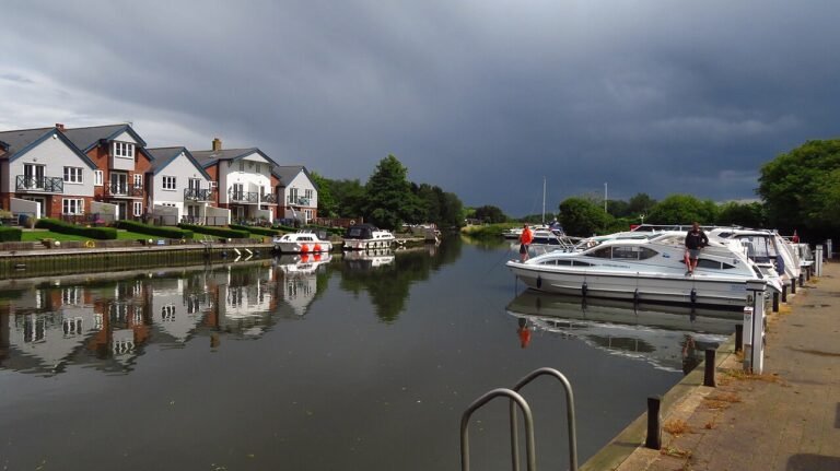
The River Wensum forms Hellesdon’s southern edge. Marriott’s Way, the 24.6-mile path for walkers, cyclists and riders between Norwich and Aylsham, follows the old railway through the parish and crosses the Wensum at Hellesdon on an A-frame bridge. Hellesdon’s own station on that line closed in 1952.
Plan the move
How we produced this guide
Sale prices are from HM Land Registry Price Paid Data: standard sales at Broadland District addresses in the NR6 5 and NR6 6 postcode sectors, 1 July 2025 to 30 June 2026, with the Norwich City addresses in the same sectors counted separately. District averages are from the UK House Price Index, July 2026. Population is from the 2021 Census. School details are from Ofsted reports and the Department for Education’s register. Council tax is from Broadland District Council’s 2026-27 council tax and budget information and Norwich City Council’s 2026-27 charges. Bus times are from the timetables on bustimes.org, checked on 24 September 2026. Drive times are typical times on the main roads. See our methodology page for source links.
Frequently asked questions
Is Hellesdon a good place to live?
For families who want a semi with a garden, good infant and junior schools and frequent buses into Norwich, yes. It has no station and no village centre, and its high school was rated Requires Improvement in 2023.
What is the average house price in Hellesdon?
The median of the 152 standard sales HM Land Registry recorded in Hellesdon in the 12 months to June 2026 was £275,000. Semis, the most common type, also had a median of £275,000, and detached houses £325,000.
How far is Hellesdon from Norwich?
About 4 miles north-west of the city centre. A typical drive along the A1067 takes 10 to 15 minutes, and the Purple Line buses on Reepham Road take about 21 minutes to Castle Meadow.
What are the schools like in Hellesdon?
Hellesdon High School, for ages 11 to 18, was rated Requires Improvement by Ofsted in October 2023 because of behaviour; its teaching and sixth form were graded Good. The infant and junior schools all have Good or Outstanding grades from inspections between 2023 and 2025.
How big is Hellesdon?
The parish had 11,126 residents at the 2021 Census, up from 10,957 in 2011. It is in Broadland district, on the north-west edge of Norwich.
Is Hellesdon a nice place to live?
If you want a village or a market town, no. If you want a family house inside the Norwich bus network, with schools and a GP close by, it does that job.
How does Hellesdon compare to Sprowston or Costessey?
All three are suburbs on the edge of Norwich without a station. Hellesdon and Sprowston are both in Broadland, where Sprowston’s 2026-27 Band D is £2,466.51 against Hellesdon’s £2,500.80; Costessey is in South Norfolk. Our Norwich commuter suburbs guide and Costessey vs Hellesdon comparison go into the detail.
Which parts of Hellesdon fall under Norwich council tax and which under Broadland?
The whole of Hellesdon parish is in Broadland, where Band D is £2,500.80. Some streets with NR6 postcodes, such as Dalrymple Way, Marauder Road and Hellesdon Road, are in Norwich City, where Band D is £2,503.43. Check the council on the listing, but the bills are almost the same.
How do I get from Hellesdon to the Norfolk and Norwich University Hospital by bus?
Take the Central Connect 512 from the Airport Park and Ride, which runs 14 times a weekday and takes about half an hour. Otherwise change in the city centre.
Related guides
Data sources: HM Land Registry, ONS Census 2021, Ofsted, Broadland District Council, Norwich City Council, bustimes.org. Prices to June 2026 (sales) and July 2026 (district index); latest Ofsted inspections. Author: Tom Fletcher, Property and Transport Editor.
Last reviewed
Still weighing it up? See how Hellesdon compares with Costessey on prices, schools, broadband and council tax, or answer five quick questions and get a shortlist of the Norfolk towns that fit you.
Planning a move to Norfolk?
Our guides to hiring the firms a move needs.
We earn no commission on these links. Paid placements are sold separately and always labelled. See our advertising and disclosure page.