All practical guides
Norfolk towns and villages: the 46 places we cover
The full list of Norfolk's towns and villages we cover, grouped by type from Norwich to the market towns, suburbs and Broads villages, with 2021 populations.

Norfolk has one city. Four large towns. Twenty-one market towns. Nine settlements that count as Norwich suburbs. And eleven villages we cover in depth. This is the full list, grouped the way most people actually think about them. Populations are from the 2021 Census where they exist. Each name links to the guide.
The word “town” is doing a lot of work here. The Office for National Statistics only counts urban subdivisions of 5,000 people and up. That leaves a real gap in the data at village scale. Holt falls below the threshold, but its Saturday high street feels like a market town. Cromer is 7,524 and reads as a small seaside resort. Wells-next-the-Sea has about 2,000 people. It is on every “best of Norfolk” list ever written. Population is not the same as character.
Norfolk’s one city: Norwich
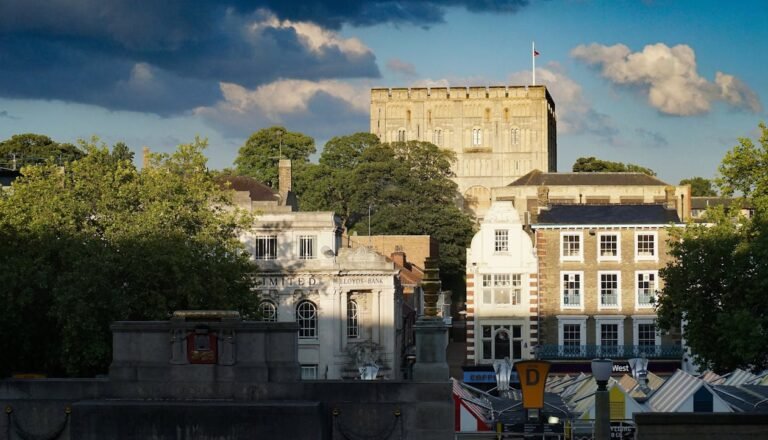
Norwich is the only city in Norfolk. The built-up area had 200,752 residents at the 2021 Census. That figure includes Thorpe St Andrew, Sprowston, Costessey, Hellesdon and Drayton. The city administrative area alone is 144,000. Everywhere else in the county is at least four times smaller. If you want a walkable centre with a cathedral, a university, a teaching hospital and a full arts programme, Norwich is the only choice.
Guide: Living in Norwich.
The four large towns
Everything above 20,000 people. The 2021 Census figures below are for the settlement itself, not the wider local-authority area. King’s Lynn borough is a lot bigger than the town.
| Town | Population (2021) | District | Guide |
|---|---|---|---|
| King’s Lynn | 47,610 | King’s Lynn and West Norfolk | Living in King’s Lynn |
| Great Yarmouth | 28,982 | Great Yarmouth | Living in Great Yarmouth |
| Thetford | 25,492 | Breckland | Living in Thetford |
| Gorleston-on-Sea | 24,481 | Great Yarmouth | Living in Gorleston-on-Sea |
Moving to Norfolk this year?
Get the free Norfolk Relocation Pack: all 46 towns we cover on one table, on price, council tax, trains, distances, broadband and schools, plus a week-by-week move checklist. The download appears here as soon as you enter your email.
Unsubscribe any time.
The market towns
Twenty-one places that function as the local centre for the villages around them. We list them alphabetically. Ranking on population would misrepresent how they work. Friday-market Fakenham has 8,385 residents. It does more for its parish network than a bedroom community twice its size.
| Town | Population (2021) | District | Guide |
|---|---|---|---|
| Attleborough | 11,232 | Breckland | Living in Attleborough |
| Aylsham | 7,184 | Broadland | Living in Aylsham |
| Cromer | 7,524 | North Norfolk | Living in Cromer |
| Dereham | 20,785 | Breckland | Living in Dereham |
| Diss | 9,599 | South Norfolk | Living in Diss |
| Downham Market | 11,342 | King’s Lynn and West Norfolk | Living in Downham Market |
| Fakenham | 8,385 | North Norfolk | Living in Fakenham |
| Harleston | 5,075 | South Norfolk | Living in Harleston |
| Hingham | under 5,000 | South Norfolk | Living in Hingham |
| Holt | under 5,000 | North Norfolk | Living in Holt |
| Hunstanton | under 5,000 | King’s Lynn and West Norfolk | Living in Hunstanton |
| Loddon | under 5,000 | South Norfolk | Living in Loddon |
| Long Stratton | 5,215 | South Norfolk | Living in Long Stratton |
| North Walsham | 12,829 | North Norfolk | Living in North Walsham |
| Reepham | under 5,000 | Broadland | Living in Reepham |
| Sheringham | 7,093 | North Norfolk | Living in Sheringham |
| Stalham | under 5,000 | North Norfolk | Living in Stalham |
| Swaffham | 8,434 | Breckland | Living in Swaffham |
| Watton | 11,543 | Breckland | Living in Watton |
| Wells-next-the-Sea | under 5,000 | North Norfolk | Living in Wells-next-the-Sea |
| Wymondham | 16,335 | South Norfolk | Living in Wymondham |
Norwich suburbs
Nine settlements that are administratively separate parishes but function as parts of the wider Norwich commute. Most sit inside the Norwich built-up area total of 200,752 rather than as standalone entries. Sprowston alone had 17,126 residents at the 2021 Census. Hellesdon had 11,126. Costessey had 12,463 at the 2011 Census, since grown with new housing at Queen’s Hills. If any of these were reported as standalone settlements they would sit around the middle of the market-town rankings.
| Suburb | Parish population (Census) | District | Guide |
|---|---|---|---|
| Costessey | 12,463 (2011) | South Norfolk | Living in Costessey |
| Cringleford | under 5,000 | South Norfolk | Living in Cringleford |
| Drayton | under 5,000 | Broadland | Living in Drayton |
| Hellesdon | 11,126 (2021) | Broadland | Living in Hellesdon |
| Hethersett | 7,021 (2021) | South Norfolk | Living in Hethersett |
| Poringland | 7,104 (2021) | South Norfolk | Living in Poringland |
| Sprowston | 17,126 (2021) | Broadland | Living in Sprowston |
| Taverham | 14,989 (2021) | Broadland | Living in Taverham |
| Thorpe St Andrew | under 5,000 as separate parish | Broadland | Living in Thorpe St Andrew |
Villages and the Broads
Eleven smaller places we cover in detail. Populations are parish-level from Norfolk Insight where available. These are the sub-5,000 settlements where the pub knows your name inside a fortnight, and the school runs on a single class per year.
| Village | Character | District | Guide |
|---|---|---|---|
| Acle | Broads gateway on the A47 | Broadland | Living in Acle |
| Blofield | Broadland commuter village east of Norwich | Broadland | Living in Blofield |
| Brundall | Wherry Line station village on the Yare | Broadland | Living in Brundall |
| Burnham Market | North-coast destination village | King’s Lynn and West Norfolk | Living in Burnham Market |
| Caister-on-Sea | Coastal village north of Great Yarmouth | Great Yarmouth | Living in Caister-on-Sea |
| Dersingham | Sandringham-adjacent village on the A149 | King’s Lynn and West Norfolk | Living in Dersingham |
| Happisburgh | Coastal village with active erosion frontage | North Norfolk | Living in Happisburgh |
| Mulbarton | Large commuter village south of Norwich | South Norfolk | Living in Mulbarton |
| Rackheath | Broadland garden-village development site | Broadland | Living in Rackheath |
| Spixworth | North Norwich fringe village | Broadland | Living in Spixworth |
| Wroxham | Broads boating capital on the Bure | Broadland | Living in Wroxham |
What the roster does and does not include
Forty-six places sounds like a lot. It is not. Norfolk contains more than 500 parishes. It has something in the order of 700 named settlements when you include the smallest hamlets. We cover the ones a mover realistically shortlists. The city. The towns with a functioning centre. The Norwich commuter belt. A set of villages that carry a distinctive property market or a landscape story worth writing about.
The county has one city. Four large towns above 20,000. Thirteen settlements above 10,000 in total. Add Wymondham, Taverham, North Walsham, Watton, Downham Market, Attleborough, Bradwell and Sprowston to the four large towns and the city. Below 10,000 the count depends where you draw the line. Another dozen or so places have true town centres. Then the villages.
Where to go next
Two ways to use this list. If you already know which place you are considering, click through to its guide. If you are trying to narrow down between towns, the compare-towns tool puts prices, schools, commute and crime side by side for any two Norfolk towns, and the five-question shortlist narrows a longlist to two or three matches in about a minute. For a purely data-led ranking of the 25 largest by population, see Norfolk towns by population 2026.
Methodology
Populations of 5,000 and above are from the 2021 Census, published by ONS in March 2023, counting “urban subdivisions” (continuously built-up settlements). Sub-5,000 populations are reported at parish level via Norfolk Insight; the two datasets use different methodologies and are not directly comparable, so we mark sub-5,000 places as “under 5,000” here rather than mix scales. Where a built-up area spans multiple named settlements (Norwich merges into Thorpe St Andrew; Great Yarmouth into Gorleston and Bradwell), ONS reports the components separately and we show them separately.
Frequently asked questions
How many towns are in Norfolk?
The exact number depends on where you draw the line between “town” and “village”. If you use the ONS 2021 urban-subdivision threshold of 5,000 residents, there are 25 settlements in Norfolk of town size. If you include places that are smaller by population but function as market towns (Holt, Hunstanton, Wells-next-the-Sea, Reepham, Loddon, Hingham, Stalham), the working figure is closer to 30.
How many cities are in Norfolk?
One. Norwich is the only settlement in Norfolk with city status; the built-up area had 200,752 residents at the 2021 Census. Kings Lynn, Great Yarmouth and Thetford are all sometimes described as “cities” in casual use, but none of them holds official city status.
What is Norfolk’s largest town after Norwich?
King’s Lynn, with 47,610 residents at the 2021 Census. Great Yarmouth is next at 28,982, then Thetford at 25,492 and Gorleston-on-Sea at 24,481. Gorleston is technically continuous with Great Yarmouth’s urban area but ONS counts it as a separate settlement.
How many villages does Norfolk have?
Something in the order of 700 named settlements below the ONS 5,000-person threshold, spread across more than 500 civil parishes. We cover eleven of them in dedicated village guides plus nine larger Norwich-suburb parishes; the rest of the county sits below the coverage bar we set for a village to earn its own guide (population, distinctive property market, or a landscape or transport story a mover would need to know).
Are all Norfolk’s suburbs part of Norwich?
Administratively no; functionally mostly yes. Sprowston, Thorpe St Andrew, Hellesdon and Drayton sit inside the ONS Norwich built-up area total. Costessey, Hethersett, Poringland, Taverham and Cringleford are separate parishes but read as Norwich commuter geography. The distinction matters for council tax, planning and MP representation more than for daily life.
Sources
- Office for National Statistics, 2021 Census, “Built-up areas in England and Wales” (published March 2023): ons.gov.uk/peoplepopulationandcommunity/housing/datasets/townsandcitiescharacteristicsofbuiltupareasenglandandwalescensus2021
- ONS Census 2021 area profiles (per-district): ons.gov.uk/visualisations/censuspopulationchange
- Norfolk Insight, parish-level population estimates: norfolkinsight.org.uk
- Norfolk County Council, Census 2021 first results: norfolk.gov.uk/article/44090/Census-2021-first-results-published
By James Ward, Norfolk Living Guide. Contributors write under editorial pseudonyms; see our about page for how the site is edited.
Planning a move to Norfolk?
Get shortlists of trusted Norfolk estate agents, removers, mortgage brokers and conveyancers. We only feature firms with verified local reviews.
We earn no commission on these links. Paid placements are sold separately and always labelled. See our advertising and disclosure page.