All area guides
Living in Happisburgh
Happisburgh's coastline has retreated about 250 metres in the last 70 years and no new defences are coming. The village core sits well back from the cliff.

Happisburgh (pronounced Haze-bruh) is a village on eroding cliffs, and North Norfolk District Council has demolished homes on Beach Road as the edge reached them, most recently three in April 2026. The Shoreline Management Plan policy for this stretch is managed realignment, and mortgages and insurance can be hard to get on homes near the edge. The village core stands further back from the cliff. HM Land Registry recorded 11 standard sales in the year to June 2026, at a median of £275,000 and ranging from £143,000 to £620,000, and Norwich is about 45 minutes by car.
Where it is: about 17 miles north-east of Norwich city centre as the crow flies, in North Norfolk district, postcode NR12.
Population 870 (ONS 2021) · Postcode NR12 0 · Shoreline policy managed realignment · St Mary’s church 15th c.
Happisburgh is a workable place to live for a buyer who has checked exactly where the property sits against the erosion maps, and a poor one for anyone buying for the sea view.
The cliff at the village frontage erodes in episodes, with the largest losses after storm surges. The Shoreline Management Plan does not propose holding the present line here, and the district council’s Coastwise programme has offered owners of homes at immediate risk a council purchase or the chance to rebuild elsewhere.
Happisburgh in brief
The civil parish had 870 residents at the 2021 Census (ONS), a count that includes Happisburgh Common and Whimpwell Green, which makes it one of the smaller villages on this stretch of coast. It is in North Norfolk district, and the postcode is NR12 0.
The three sales registered in the first quarter of 2026 were at £205,000, £275,000 and £340,000. Homes close to the cliff edge are priced down for the erosion risk, which is why the village median of £275,000 tells you little about any one house.
The Environment Agency’s National Coastal Erosion Risk Map gives projected erosion for each stretch of this cliff. Check the stretch in front of any house you look at.
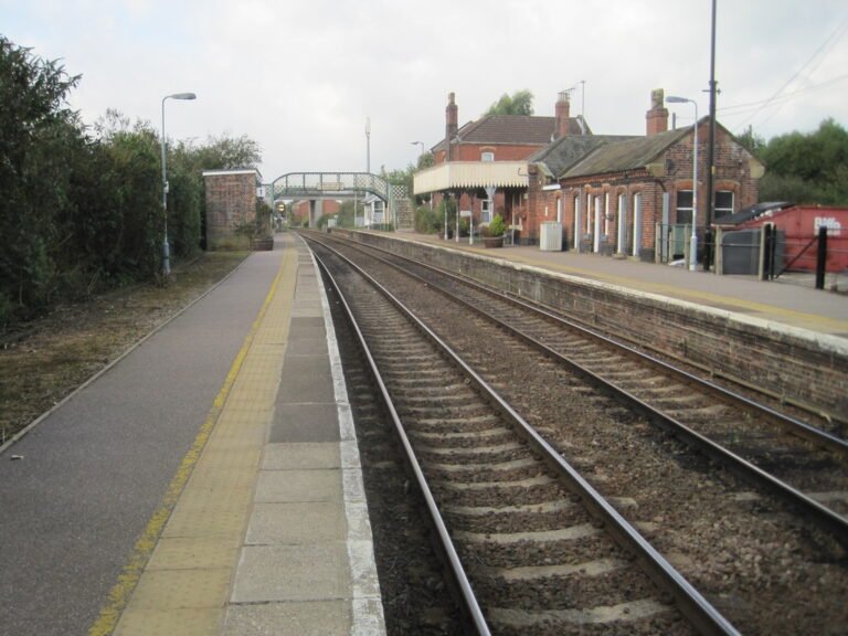
North Walsham is 8 miles inland, and its station on the Bittern Line to Norwich is 15 minutes away by car. Cromer is about 14 miles north-west along the coast by road, and Norwich 25 miles south.
The village
Happisburgh falls into three parts. The clifftop end, with the old lifeboat ramp and what remains of Beach Road, is where erosion has done the most damage. Beach Road was a full street of houses in living memory, and most of it has now gone.
The village proper sits several hundred metres back. It is centred on St Mary’s, a flint church that is largely 15th-century, with the Hill House Inn, the village shop, the school and the Grade II* listed Happisburgh Manor around it. The church tower is a sea-mark visible for miles along this coast. The village also has the Wenn Evans Centre, the village hall, and a recreation ground with a cricket club, a bowling green and a sports pavilion.
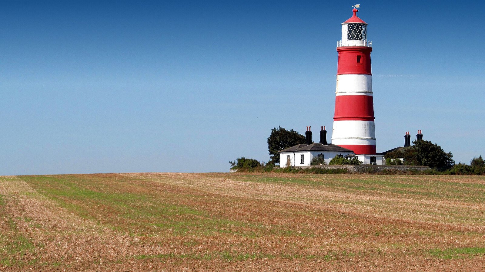
Between the clifftop and the core stands the red-and-white striped lighthouse, built in 1790. It is the only independently run working lighthouse in Great Britain: Trinity House planned to switch it off in 1988, and since 1990 the Happisburgh Lighthouse Trust has operated it under its own Act of Parliament. It opens to the public on set dates.
Thinking about moving to Happisburgh?
Get the free Norfolk Relocation Pack: Happisburgh and the other 45 towns we cover on one table, on price, council tax, population, trains and distance to Norwich, plus a week-by-week move checklist. The download appears here as soon as you enter your email.
Unsubscribe any time.
Coastal erosion
In most Norfolk villages a buyer’s first questions are about schools and prices. Here the first question has to be about erosion. The cliff is soft glacial material and erodes in episodes, with the largest losses after North Sea storm surges such as the one in December 2013. How far back is far enough depends on the stretch of cliff, so check the Environment Agency’s erosion projections for the address.
The exceptions are specific. Properties on or immediately next to the former Beach Road, properties on the last remaining stretch of clifftop lane, and any property whose deeds show a garden or field running to the cliff edge all carry active erosion exposure, and they are cheaper for that reason. Insurance and mortgages can be hard to get on them. The Kelling to Lowestoft Ness Shoreline Management Plan (SMP6), prepared by the coastal councils and the Environment Agency, puts Happisburgh in policy unit 6.12, Ostend to Eccles, one of the stretches it does not expect to defend in the long term. The policy is managed realignment: the shoreline is allowed to move back, with occasional works to slow erosion while homes and roads are relocated. There is no government compensation for homes lost to erosion. When three Beach Road houses were demolished in April 2026, the council’s Coastwise programme paid their occupants between £40,000 and £100,000 each from a national grant and a council fund that it says is nearly exhausted. If you buy on or near the cliff, assume the house has a limited life.
The one postcode covers homes at the cliff edge and homes several hundred metres back, so check the specific address, not the village.
Check the listing’s erosion information yourself: the Environment Agency’s coastal erosion service shows both the projected erosion and the shoreline management policy for an address. Because losses come in episodes, one bad surge can move the practical boundary of what is insurable, so check the erosion map again before exchange as well as at the offer stage.
Schools
The village primary is Happisburgh Church of England Primary Academy, formerly Happisburgh CofE VA Primary, which joined the St Benet’s multi-academy trust in August 2024. Its intake is small, as is usual for a rural coastal school. At secondary age, children go to Stalham High School (Good), about 15 minutes inland, or to Cromer Academy (Good) along the coast. For sixth form the options are Paston College in North Walsham or Easton College.
Getting to work
Happisburgh is not a commuter village, and it has no station of its own, so a car is essential. The nearest station is North Walsham, 8 miles inland, roughly to the west, and 15 minutes’ drive away, from which the Bittern Line runs hourly to Norwich in about 25 minutes. Driving to Norwich takes 45 to 55 minutes on the A149 and B1150. The one bus link is the Sanders 34/34A between North Walsham and Stalham, calling at Mundesley, Bacton, Walcott, Happisburgh and Sea Palling. It runs on weekdays only and is not a commuter service. Anyone with a daily London or Cambridge commitment should look elsewhere; for remote workers and retirees the road access is adequate.
What the money buys
HM Land Registry recorded 11 standard sales in Happisburgh in the 12 months to June 2026, none of them new builds: six detached houses, four semis and one terraced house. The cheapest was a terraced house on Whimpwell Street at £143,000 and the dearest a detached farmhouse on North Walsham Road at £620,000. Two detached houses on Lighthouse Close sold for £210,000 and £260,000, and a semi on School Common Road for £340,000.
Properties next to the clifftop are priced down for the erosion risk. Insurance and a mortgage may not be available on them, so check both before you offer.
The beach and the wider area
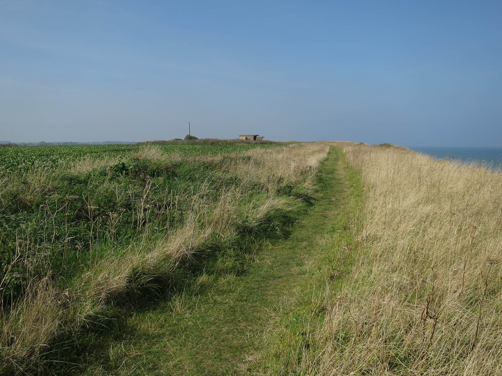
The beach is reached by the replacement ramp at Cart Gap, where Smallsticks Cafe serves the walkers. At low tide the sand runs a long way in each direction, and the Norfolk Coast Path runs along the clifftop. The lighthouse opens on set days, and St Mary’s Church repays an hour for anyone interested in medieval Norfolk building. The Hill House Inn has a reputation as Arthur Conan Doyle’s inspiration for parts of The Adventure of the Dancing Men.
The village has none of the tourist-season crush or the second-home density of a place like Wells, and out of season it is quiet even by north Norfolk standards. The winters are raw: the village faces the North Sea with nothing in the way, and this is not sheltered living. Village amenities cover the basics and little more. Stalham, 10 minutes inland, handles everyday shopping; Cromer, 20 minutes up the coast, is the nearest full seaside town; North Walsham, 15 minutes away, has the station and the market. Specialist shops, restaurants and cultural events mean a trip to Norwich. The Broads begin at Stalham and Hickling, both within a 15-minute drive.
Who Happisburgh suits
Happisburgh is two housing markets sharing one postcode. In the village core behind St Mary’s, erosion is a long-term question for the village; on the cliff line it is the first question for the house.
The village suits buyers who prefer the real Norfolk coast to a polished one, retirees and remote workers who are happy to reach the rest of the county by car, and anyone who has checked a specific property against the erosion maps before buying. It does not suit commuters, anyone who wants a coast with shops and services close together (try Cromer or Sheringham), or buyers drawn to the cheap clifftop stock without understanding what they are buying. Work out which of the two markets a house belongs to before the lighthouse wins you over.
Nearby places
- Cromer, about 14 miles north-west by road: a larger coastal town with the full range of services and a station on the Bittern Line.
- North Walsham, 8 miles inland: a market town with a Bittern Line station and cheaper family housing.
- Norfolk coastal erosion: a buyer’s guide to the at-risk villages, with the full checklist for any at-risk coastal purchase.
- Norfolk flood risk, on flooding and surface water for any coastal buyer.
Plan the move
How we produced this guide
Property prices are from HM Land Registry Price Paid Data, standard sales with a Happisburgh address, for the 12 months to June 2026. Population is from the 2021 Census, and school ratings from Ofsted reports. The shoreline policy is from the Kelling to Lowestoft Ness Shoreline Management Plan, and the Beach Road demolitions and Coastwise payments from North Norfolk District Council. Train times are from Greater Anglia’s published timetables. Drive times are typical times on the main roads. We update this guide quarterly. See our methodology page for source links.
Frequently asked questions
Is Happisburgh safe to buy in?
It depends on the property. Clifftop and former Beach Road homes have been lost to the sea, and the frontage is managed realignment. Before committing, check the specific property against the Environment Agency coastal erosion map and the Shoreline Management Plan.
How much does a house in Happisburgh cost?
HM Land Registry recorded 11 standard sales in the 12 months to June 2026, with a median of £275,000 and a range from £143,000 to £620,000. Clifftop-adjacent properties sell at a discount for the erosion risk and are usually cash-only.
Why is Happisburgh famous?
For its red-and-white striped lighthouse, the only independently operated lighthouse in Great Britain, and for the cliff erosion that has taken homes on Beach Road. It is also where human footprints more than 800,000 years old were found on the beach in 2013, the oldest known human footprints outside Africa.
Data sources: HM Land Registry, ONS Census 2021, Ofsted Reports, Greater Anglia timetables. Sales to June 2026; latest Ofsted inspections. Author: Sarah Ellis, Coast and Broads Editor.
Still weighing it up? See how Happisburgh compares with Caister-on-Sea on prices, schools, broadband and council tax, or answer five quick questions and get a shortlist of the Norfolk towns that fit you.
Planning a move to Norfolk?
Our guides to hiring the firms a move needs.
We earn no commission on these links. Paid placements are sold separately and always labelled. See our advertising and disclosure page.
Keep reading
Similar Posts
Living in Harleston
Harleston still has a town centre people use every week, and since November 2025 a Lidl beside the Co-op. What it lacks is a railway.Living in Dereham
Dereham is where the villages of mid-Norfolk come to shop, see a doctor and go to secondary school. It has no railway station.Living in Thorpe St Andrew
Thorpe St Andrew is the Norwich suburb with its own school to 18, rated Good in every area in April 2025. Buses reach Castle Meadow in about 11 minutes.Living in Dersingham
Dersingham is a large village on the edge of the Sandringham estate, with a GP, a Co-op and a half-hourly bus to King’s Lynn. It is no cheaper than Hunstanton.Living in Reepham
Reepham is a small market town 12 miles north-west of Norwich that still works as a town, with a deli, independent shops, a Co-op and the Marriott’s Way cycle path to the city.Living in Acle
Acle is one of the few Broadland villages where you can get to work in Norwich or Great Yarmouth without a car, by train or on the half-hourly X1 bus.