Norfolk Flood Risk: What Buyers Need to Know Before Moving
Independent guide to flood risk across Norfolk. Tidal versus fluvial versus surface water, district-by-district risk, Flood Re eligibility and the buyer due diligence checklist.
Norfolk flood-risk zones by district (2026)
Qualitative flood-risk band. Source: Environment Agency Flood Map for Planning, Anglian Water surface-water studies, EA tidal flood model.
Quick Verdict
Norfolk has more flood risk than almost any other English county, but that does not mean writing off whole areas. Around the Broads, the Fens, the North Norfolk coast, Great Yarmouth, and King’s Lynn, large pockets sit in Environment Agency Flood Zone 2 or 3. The trick is knowing how to read the maps, getting insurance quotes before you exchange, and understanding which defences actually protect the postcode you are buying into. This guide walks through the three flood types you’ll meet here, the zones to watch, the towns most exposed, how Flood Re still keeps premiums affordable in 2026, and the practical checks every Norfolk buyer should run before signing.
Why Norfolk Has Higher Flood Risk Than Most Counties
Norfolk sits on the eastern edge of England, jutting out into the North Sea. Much of the county is barely above sea level, and some areas in the Fens and the Broads are actually below it. That geography alone makes Norfolk more exposed to flooding than most of the country. Add in a long, low coastline, several slow-moving rivers, and flat terrain that drains poorly after heavy rain, and you have a county where flood risk needs to be on every buyer’s checklist.
Three Types of Flood Risk in Norfolk
1. Coastal and Tidal Flooding
The North Norfolk coast and the stretch from Great Yarmouth down to Lowestoft are vulnerable to tidal surges, particularly when strong northerly winds coincide with high spring tides. The devastating 1953 North Sea flood is still within living memory for some Norfolk residents, and smaller surge events happen more regularly than many newcomers realise. Happisburgh has become nationally known for coastal erosion, with homes literally falling into the sea. Further west, Wells-next-the-Sea and the salt marshes around Blakeney are regularly inundated by tidal water, though these areas are largely protected marshland rather than residential.
2. River Flooding
Norfolk’s rivers move slowly across very flat land, which means they can back up quickly after sustained rainfall. The key rivers to be aware of are the Wensum (which runs through Norwich), the Yare, the Bure, the Waveney, and the Great Ouse around King’s Lynn. The Broads, a network of rivers and shallow lakes in eastern Norfolk, present a particular challenge because the water table is already so high. Villages such as Wroxham, Stalham, Acle, and Loddon all sit close to Broads waterways and include pockets of Flood Zone 2 and 3 land.
3. Surface Water Flooding
Because Norfolk is so flat, rainwater has nowhere obvious to go. After heavy downpours, surface water can pool in low spots, overwhelm drains, and flood properties that are nowhere near a river or the coast. This type of flooding is harder to predict from maps alone. It tends to affect individual streets or estates rather than whole towns, and it can happen almost anywhere in the county. The Environment Agency’s surface water flood maps are worth checking alongside the river and coastal maps.
Understanding Environment Agency Flood Zones
The Environment Agency classifies land into three flood zones, and these designations directly affect planning decisions, insurance costs, and property values.
Flood Zone 1 (Low Risk): Less than a 0.1% chance of flooding in any given year from rivers or the sea. Most of inland Norfolk, including towns like Wymondham, Dereham, and Attleborough, sits in Zone 1.
Flood Zone 2 (Medium Risk): Between 0.1% and 1% annual chance of river flooding, or between 0.1% and 0.5% for sea flooding. Parts of Norwich along the River Wensum fall into Zone 2, as do areas on the edges of the Broads.
Flood Zone 3 (High Risk): More than a 1% annual chance of river flooding or more than a 0.5% chance of sea flooding. Significant parts of Great Yarmouth, King’s Lynn, the Broads villages, and the low-lying Fens around Downham Market are in Zone 3.
Norfolk Areas With Notable Flood Risk
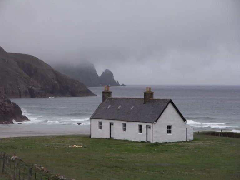
The Broads and Surrounding Villages
The Broads are beautiful, but they exist because the land is waterlogged. Properties in Wroxham, Stalham, Acle, Loddon, and the smaller hamlets scattered between them can sit right on the edge of Flood Zone 3. If you are drawn to Broads living, pay close attention to the specific plot elevation and flood history of any property. Some homes have been flooded multiple times; others, just a few hundred metres away, have never had water inside.
Great Yarmouth
Great Yarmouth faces a double threat: tidal surges from the North Sea and river flooding from the Yare and Bure. The town has significant flood defences, including flood walls along the river and tidal barriers, but large sections of the borough remain in Flood Zone 3. The ongoing Great Yarmouth flood defence programme is one of the largest in the country, so the situation is improving, but buyers should still check individual property locations carefully.
King’s Lynn
King’s Lynn sits at the southern tip of The Wash, where the River Great Ouse meets tidal water. The town relies on flood walls and embankments for tidal defence, and the Denver Sluice further upstream on the River Great Ouse helps manage water levels. However, low-lying land along the Ouse remains in higher flood zones. The Fens to the south of the town, around Downham Market, are some of the lowest land in England, kept dry by a network of drainage pumps that have been working since the 17th century.
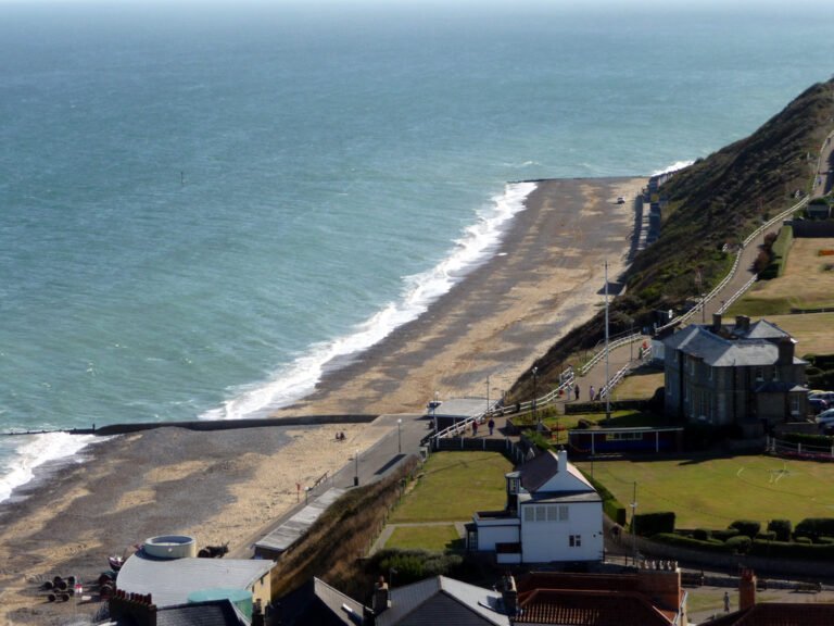
North Norfolk Coast
Happisburgh deserves a specific mention because its problem is coastal erosion rather than flooding in the traditional sense. The soft clay cliffs are retreating at a rate that has already claimed dozens of homes, and the managed retreat policy means no new sea defences will be built there. Further along the coast, Wells-next-the-Sea, Cley, and Blakeney sit behind salt marshes that act as natural flood buffers. Residential areas are mostly safe, but properties on the harbour front or closest to the marshes should be checked thoroughly.
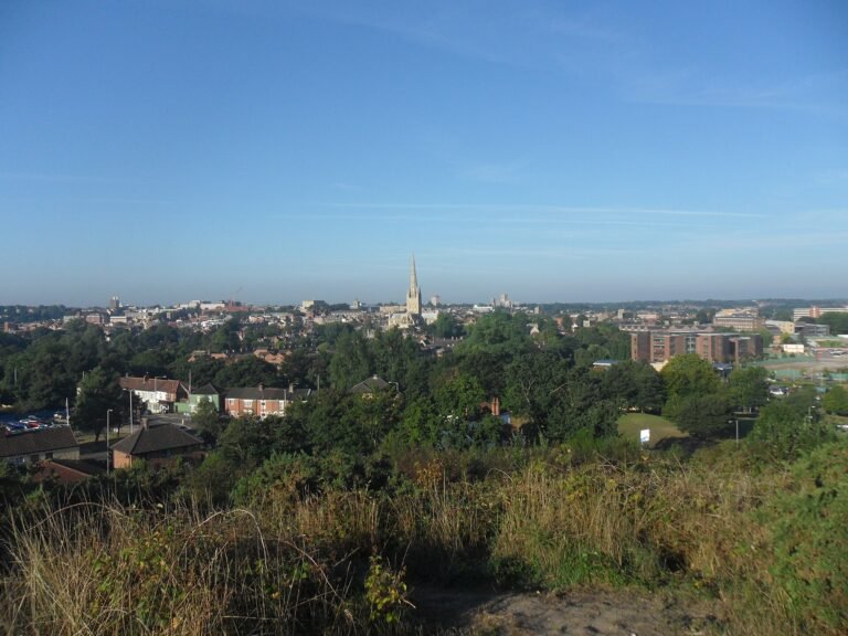
Norwich
Norwich is mostly well above flood level, but the River Wensum winds through the city centre, and pockets of land along its banks sit in Flood Zone 2 or 3. Riverside apartments and some older properties near the river, particularly around Carrow Road and the lower stretches near Thorpe St Andrew, need individual assessment. The city has benefited from riverside flood defence works, but the risk is not zero for properties closest to the water.
The Fens Around Downham Market
The Fens are some of the most productive farmland in England, and they are also some of the lowest land. Much of the area around Downham Market relies on pumped drainage to stay dry. While this system works well and has done for centuries, climate change and rising sea levels mean that buyers here should understand the infrastructure that keeps the water at bay. Properties in the Fens are generally affordable, but flood risk is one reason why.
Norfolk’s Flood Defences
Norfolk has substantial flood defence infrastructure, and it is worth understanding what protects the area you are looking at.
The King’s Lynn Tidal Barrier can close across the River Great Ouse when tidal surges threaten. It has operated successfully in several major surge events and is a key reason why central King’s Lynn has avoided the worst flooding in recent decades.
Great Yarmouth’s flood walls and barriers run along the river and seafront, with a major upgrade programme underway that will extend and raise defences further. Once complete, this will significantly reduce the area of the borough in the highest flood zones.
Norwich riverside defences include raised walls and embankments along the Wensum through the city centre. These were improved after the 1912 flood and have been upgraded at intervals since.
Across the Broads, the Environment Agency maintains river banks, sluices, and pumping stations that manage water levels. These are effective but require ongoing investment, particularly as sea levels rise.
How to Check Flood Risk Before You Buy
The single most important tool is the Environment Agency’s long-term flood risk service, available free at gov.uk/check-long-term-flood-risk. Enter any postcode or address and you will see the flood zone, the risk from rivers and the sea, and the risk from surface water, all on a detailed map.
Beyond the online tool, here is what to do when you are seriously considering a property in Norfolk:
Ask the estate agent directly whether the property has ever flooded. Sellers are required to disclose this on the property information form, but asking the question early saves time.
Get insurance quotes before you exchange contracts. This is critical. A property in Flood Zone 3 may still be insurable at a reasonable cost thanks to the Flood Re scheme (more on that below), but you need to confirm this in writing before you are legally committed.
Commission a full environmental search as part of your conveyancing. Your solicitor will normally do this, but make sure it includes flood risk data rather than just a basic local authority search.
Talk to the neighbours. Long-term residents will know whether a street has flooded, how deep the water got, and how quickly it drained. This kind of local knowledge does not always show up in official reports.
Insurance: The Flood Re Scheme and What It Means for Buyers
Flood Re is a joint reinsurance scheme between the UK government and the insurance industry. It is the single biggest reason flood-risk homes in Norfolk are still insurable on normal terms. Participating insurers pass the flood element of your buildings or contents policy to Flood Re at a capped premium, so even properties in Flood Zone 3 can usually get cover at a sensible price.
To qualify, the property must meet all of the following:
- Built and given a Council Tax band before 1 January 2009.
- Located in England, Wales, Scotland, or Northern Ireland (Channel Islands and Isle of Man are excluded).
- Used as the main residence by you or immediate family. Buy-to-let, second homes, and holiday lets are not covered.
- Houses, single flats, blocks of flats (with limits), and mobile homes on licensed caravan sites are eligible. Commercial property is not.
The pre-2009 cut-off is deliberate. It exists to discourage new building in flood-prone land, so if you are looking at a Norfolk new-build in a flood zone, do not assume Flood Re will catch you. Get a written insurance quote before you exchange, and ask the developer what flood resilience measures (raised electrics, non-return valves, flood doors) are built into the spec.
Flood Re is currently scheduled to run until 2039. After that, the market is expected to move to risk-reflective pricing. For anyone buying in Norfolk in 2026, that is still a long way off, but it is worth thinking about if you plan to hold the property into the late 2030s or pass it on. A house that comfortably qualifies for Flood Re today may face higher premiums or restricted cover once the scheme ends.
Practical Steps Once You Have Moved In
If you buy a property with any level of flood risk, there are straightforward steps you can take to protect yourself.
Sign up for Environment Agency flood warnings. The free service sends alerts by phone, text, or email when flooding is expected in your area. Registration takes two minutes at gov.uk/sign-up-for-flood-warnings.
Know your local flood warden. Many Norfolk parishes have volunteer flood wardens who coordinate the community response during flood events. Your parish council can tell you who they are.
Prepare a flood plan. The Environment Agency provides templates. Knowing in advance where to move valuables, how to turn off utilities, and where to go if you need to evacuate makes a stressful situation much more manageable.
Consider property-level flood resilience measures. Flood doors, airbrick covers, non-return valves on drains, and raised electrical sockets can all reduce the damage if water does enter your home. Some of these are surprisingly affordable and can also reduce your insurance premiums.
Should Flood Risk Put You Off Buying in Norfolk?
No, but it should make you more careful. Thousands of people live happily in Norfolk’s flood-risk areas, many of them in properties that have never actually flooded. The key is to go in with your eyes open: check the maps, get the insurance quotes, understand the defences, and make an informed decision.
If you want to live near the Broads, the coast, or one of Norfolk’s beautiful river towns, flood risk is simply part of the equation. Treat it the way you would treat any other factor in a property purchase: research it thoroughly, budget for it, and plan for it. Norfolk is a wonderful place to live, and a bit of homework on flood risk will help you find the right home with confidence.
Useful Resources
Check long-term flood risk (gov.uk), Enter any postcode to see the Environment Agency’s flood maps.
Sign up for flood warnings (gov.uk), Free alerts for your area.
Flood Re, Check whether a property is eligible for the scheme.
For more on individual Norfolk towns mentioned in this guide, see our town profiles: Great Yarmouth, King’s Lynn, Wroxham, Stalham, Acle, Loddon, Downham Market, and Norwich.
For details on how we research our guides, see our methodology page.
Three real Norfolk flood-risk buyer scenarios.
The Broads cottage in flood zone 3. EA classification: High tidal/fluvial flood risk. Flood Re eligibility: Yes if pre-2009 primary residence. Premium: £500-800 for buildings + flood cover. Verdict: Workable with Flood Re; check excess.
The Norwich riverside flat. EA classification: Surface-water risk; minor tidal. Flood Re eligibility: Yes (pre-2009). Premium: £400-600 typical. Verdict: Manageable; ground-floor flats higher excess.
The fenland farmhouse near drain. EA classification: Flood zone 2/3. Flood Re eligibility: Yes if pre-2009 primary. Premium: £600-1,000+. Verdict: Requires specialist broker; flood-resilience upgrades reduce premium.
Plan the move
What to watch in 2026
- Property price trajectory. Norfolk’s 2026 trend tracks the county-wide -1 to -2% on the 12-month rolling mean.
- Greater Anglia / rail timetables. Mid-2026 changes affect rail-served towns and villages.
How we produced this guide
Property prices come from HM Land Registry sold-price data 12 months to March 2026. Population data from ONS Census 2021. School ratings from Ofsted Reports. Train times via Greater Anglia published timetables; drive times from Google Maps weekday-peak. Crime data from Police.uk for the Norfolk Constabulary force area. We update this guide quarterly. See our methodology page for source links.
Last reviewed · reviewed quarterly
Planning a move to Norfolk?
Get shortlists of trusted Norfolk estate agents, removers, mortgage brokers and conveyancers. We only feature firms with verified local reviews.
Some links are paid partnerships. We only recommend firms we would use ourselves. See our affiliate disclosure.