Norfolk Coastal Erosion: A Buyer’s Guide to the At-Risk Villages
Independent Norfolk coastal erosion buyer's guide for 2026. SMP5 and SMP6 zones explained, the four policies, eight at-risk villages, three buyer scenarios across Hold/Realign/NAI zones with mortgage and insurance reality, and 8-question FAQ.
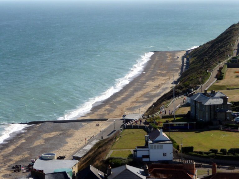
Around 3,500 Norfolk and Suffolk properties sit at direct coastal-erosion risk up to 2055. The Norfolk coast loses roughly 1.7 metres of cliff per year on average, and the council intent for any specific property is set by the Shoreline Management Plan (SMP). Estate agents are not legally required to disclose any of this. This guide is the plain-English buyer’s reference: the four SMP policies, the eight Norfolk villages where extra due diligence is non-negotiable, three real buyer scenarios across the three SMP zones, and the eight questions to ask before you offer.
Norfolk coastal erosion in five numbers
- 1.7 metres per year average cliff retreat across the soft-cliff Norfolk coast (variable from 0.3m to 5m+ in extreme years).
- 3,500 Norfolk and Suffolk properties at direct coastal risk by 2055 across the SMP5 and SMP6 plans.
- 4 SMP policies a property can sit under: Hold the Line, Advance the Line (unused in Norfolk), Managed Realignment, No Active Intervention.
- 3 epochs per policy assignment: 0-20 years, 20-50 years, 50-100 years from the 2005 baseline.
- 8 Norfolk villages where buyer due diligence is non-negotiable: Happisburgh, Hemsby, Overstrand, Mundesley, Walcott, Bacton Village, Winterton-on-Sea, Salthouse.
Norfolk coastal villages by SMP medium-term policy (2026-2055)
Bar widths represent qualitative defence intent for the medium-term epoch. Mixed status reflects properties within a village having different SMP unit assignments. Always confirm specific property zone before committing. Source: Norfolk Coastal Partnership SMP5 + SMP6 published documents.
Why This Guide Exists
Estate agents in England are not legally required to warn buyers that a property sits inside a coastal erosion risk zone. On a stretch of coast where around 1.7 metres of cliff is lost every year on average, and where around 3,500 Norfolk and Suffolk properties are already at direct coastal risk up to 2055, that silence can be the difference between a good buy and a life-altering mistake. This guide is not a planning document. It is a plain-English summary of the official Shoreline Management Plans for every named section of the Norfolk coast, so that you know before you view a property whether the council intends to defend the shoreline in front of it, or to let nature take its course.
What a Shoreline Management Plan Actually Is
Every stretch of the English coast is covered by a Shoreline Management Plan, or SMP. These are non-statutory documents produced by the Environment Agency and coastal local authorities, but they are the framework councils actually use when deciding whether to maintain, upgrade, or abandon sea defences. Norfolk’s coast sits inside two plans: SMP5 (Hunstanton to Kelling Hard) covers the west and north-west, and SMP6 (Kelling Hard to Lowestoft Ness) covers everything east of Weybourne down to the Suffolk border. Both plans divide the coast into small management units, usually a village or a stretch of cliff, and assign each one of four policies across three time periods, or epochs.
The Four SMP Policies in Plain English
- Hold the Line. Maintain or upgrade the existing defences. The council intends to keep the shoreline broadly where it is now. This is the strongest signal that a settlement is considered worth defending long term.
- Advance the Line. Actively push defences further out to sea. Not used on the Norfolk coast.
- Managed Realignment. Allow the coastline to move inland, but in a controlled way, sometimes with temporary or partial defences to protect specific assets during the transition.
- No Active Intervention. Do nothing. The shoreline will retreat at whatever rate nature dictates. Existing defences are not maintained.
Each unit is assigned a policy for three epochs: short term (0 to 20 years from the plan’s 2005 baseline, so roughly to 2025), medium term (to around 2055), and long term (to around 2105). A policy change between epochs is a signal that the council accepts the defence is not sustainable forever, even if it is being maintained today.
The Norfolk Coast Village by Village
The table below summarises every named management unit along the Norfolk coast, using the official SMP5 and SMP6 policy data published by the Environment Agency. Villages marked Hold the Line across all three epochs are the most protected. Villages where the policy shifts to Managed Realignment or No Active Intervention in the medium or long term are the ones where the council has already accepted that the current shoreline will not be held indefinitely.
West and North Norfolk Coast (SMP5: Hunstanton to Kelling Hard)
| Section | Short term (to around 2025) | Medium term (to around 2055) | Long term (to around 2105) |
|---|---|---|---|
| Old Hunstanton Dunes | Hold the line | Managed realignment | Managed realignment |
| Holme dunes | Managed realignment | Managed realignment | Managed realignment |
| Thornham Sea Bank | Hold the line | Hold the line | Managed realignment |
| Thornham village | No active intervention | No active intervention | No active intervention |
| Titchwell village | No active intervention | No active intervention | No active intervention |
| Brancaster and Brancaster Staithe | Hold the line | Hold the line | Hold the line |
| Burnham Overy Staithe | Hold the line | Hold the line | Hold the line |
| Holkham dunes | Managed realignment | Managed realignment | Managed realignment |
| Wells flood embankment, quay and east bank | Hold the line | Hold the line | Hold the line |
| Morston | Hold the line | Hold the line | Hold the line |
| Blakeney | Hold the line | Hold the line | Hold the line |
| Cley to Salthouse | Managed realignment | Managed realignment | Managed realignment |
North and East Norfolk Coast (SMP6: Kelling Hard to Lowestoft Ness)
| Section | Short term (to around 2025) | Medium term (to around 2055) | Long term (to around 2105) |
|---|---|---|---|
| Kelling Hard to Sheringham | No active intervention | No active intervention | No active intervention |
| Sheringham | Hold the line | Hold the line | Hold the line |
| Sheringham to Cromer | Managed realignment | No active intervention | No active intervention |
| Cromer | Hold the line | Hold the line | Hold the line |
| Cromer to Overstrand | Managed realignment | No active intervention | No active intervention |
| Overstrand | Hold the line | Managed realignment | Managed realignment |
| Overstrand to Mundesley | Managed realignment | No active intervention | No active intervention |
| Mundesley | Hold the line | Hold the line | Managed realignment |
| Mundesley to Bacton Gas Terminal | Managed realignment | No active intervention | No active intervention |
| Bacton Gas Terminal | Hold the line | Hold the line | Hold the line |
| Bacton, Walcott and Ostend | Hold the line | Managed realignment | Managed realignment |
| Ostend to Eccles (includes Happisburgh) | Managed realignment | Managed realignment | Managed realignment |
| Eccles to Winterton | Hold the line | Hold the line | Hold the line |
| Winterton-on-Sea (south of Beach Road) to Scratby (includes Hemsby) | Managed realignment | Managed realignment | Managed realignment |
| California to Caister-on-Sea | Hold the line | Managed realignment | Managed realignment |
| Caister-on-Sea | Hold the line | Hold the line | Managed realignment |
| Great Yarmouth | Hold the line | Hold the line | Hold the line |
| Gorleston | Hold the line | Hold the line | Hold the line |
| Gorleston to Hopton | Managed realignment | No active intervention | No active intervention |
| Hopton | Hold the line | Hold the line | Hold the line |
Source: Environment Agency Shoreline Management Plan data, SMP5 and SMP6 policy CSVs published at environment.data.gov.uk/shoreline-planning.
The Villages Where You Need To Do Extra Homework
Happisburgh
Happisburgh sits within the Ostend to Eccles management unit, which is on a Managed Realignment policy across every epoch. The SMP is explicit: defending Happisburgh long term would create a promontory that blocks sediment drift and undermines the rest of the coast, so new defences will not be economically justified. The short-term policy is to slow the rate of loss using temporary measures such as the existing rock bund, while giving residents time to adapt. Historic data puts average cliff recession at around 1.7 metres a year, with 20 metres lost at one cliff-top location between 2004 and 2007 alone. If you are looking at a Happisburgh property, distance from the current cliff edge is the single most important figure, followed by whether the property is included in any of the Coastwise transition plans currently being developed by North Norfolk District Council.
Hemsby
Hemsby falls inside the Winterton-on-Sea (south of Beach Road) to Scratby unit, on Managed Realignment across all three epochs. Hemsby beach has retreated more than 300 metres since the 1970s, and in February 2023 the beach was closed and cliff-top properties were evacuated following a storm. Several homes have been demolished since. Buying here requires the same discipline as Happisburgh: look at the current cliff-edge distance, ignore seller estimates, and check the Environment Agency’s coastal erosion risk map before you view the property.
Overstrand, Mundesley, Walcott and Bacton Village
These settlements are currently on Hold the Line in the short term, but all four shift to Managed Realignment in the medium or long term. The practical reading is that defences are being maintained today and into the 2020s and 2030s, but the council has already accepted that the current shoreline will not be held forever. The Bacton sandscaping scheme, completed in 2019 to protect the Bacton Gas Terminal and the adjacent villages of Bacton and Walcott, is itself a temporary buffer rather than a permanent seawall. Properties here are not at imminent risk, but the trajectory is clear, and insurance, resale, and mortgage availability may all tighten as the medium-term epoch approaches.
Winterton-on-Sea
The management picture at Winterton is split. The section from Eccles to Winterton is on Hold the Line. The section south of Beach Road (running down to Scratby and taking in Hemsby) is on Managed Realignment across all three epochs. Which side of Beach Road a property sits on matters enormously.
Salthouse and Cley-next-the-Sea
The Cley to Salthouse section is on Managed Realignment across all three epochs. These villages are beloved of second-home buyers, but the SMP is explicit that the shoreline here is expected to shift inland over time. Cley marshes are already being allowed to adapt. Property itself in Cley village and Salthouse is not necessarily on the front line today, but sea surge and overtopping events are an ongoing factor, and flood insurance is a non-negotiable part of the due diligence.
Villages With Strong Long-Term Defence
These settlements are on Hold the Line across every epoch of the SMP, meaning the Environment Agency and the relevant council intend to maintain existing defences well into the 22nd century. They are the lowest-risk sections of the Norfolk coast from a pure erosion-policy point of view.
- Brancaster and Brancaster Staithe
- Burnham Overy Staithe
- Wells-next-the-Sea (flood embankment, quay and east bank)
- Morston
- Blakeney
- Sheringham
- Cromer
- Bacton Gas Terminal frontage (note: the village of Bacton itself is a separate unit)
- Eccles to Winterton
- Great Yarmouth
- Gorleston
- Hopton
Hold the Line does not mean zero risk. Defences still need to be maintained, tidal flood zones still exist behind the seawalls, and a Hold the Line policy relies on the Environment Agency and the council continuing to secure funding for future schemes. But it is a clear signal that national policy currently considers the settlement worth defending for the long term, and that planning, insurance, and mortgage markets should remain broadly normal.
The Coastwise Project and Coastal Adaptation Pilot
North Norfolk District Council runs a programme called Coastwise, which is the council’s delivery arm for the Coastal Transition Accelerator Programme. Coastwise works with communities between Weybourne and Happisburgh on adaptation planning for a coast that is no longer going to be held in its current position. In January 2026 the council confirmed further Environment Agency funding extending the Coastwise project through to 2029, and a pilot Coastal Home Assurance Scheme is being scoped as part of the national Coastal Adaptation Pilot.
If you are buying in a village that falls within the Weybourne to Happisburgh stretch, it is worth asking whether the property is part of any Coastwise transition plan, and what the parish council has been told about the expected trajectory of the shoreline in that specific community. Coastwise is not a property purchase scheme and cannot give you a pay-out if your home erodes, but the transition plans are the clearest publicly available summary of what the council expects to happen to each settlement.
Due Diligence Checklist Before You Offer
- Check the SMP policy for the exact management unit. Use the tables above or go to environment.data.gov.uk/shoreline-planning and open SMP5 or SMP6.
- Check the Environment Agency’s National Coastal Erosion Risk Map. It shows projected shoreline positions for 0 to 20 years, 20 to 50 years and 50 to 100 years for every section of English coast. Measure the distance from the property to each projected line.
- Pull the Environment Agency’s Long Term Flood Risk map for the address. Coastal erosion and tidal flooding are separate risks, and a property can be affected by one, the other, or both.
- Get specific flood and subsidence insurance quotes before exchange. Many coastal Norfolk properties are only insurable via the Flood Re scheme, which has its own eligibility rules and a scheduled end date of 2039.
- Ask the seller and their solicitor about any Coastwise, CTAP or Coastal Adaptation Pilot correspondence. If the council has written to the owner about transition planning, that is material information.
- Ask your lender about coastal erosion policies up front. Some mortgage lenders will not lend on properties within a set distance of an eroding cliff regardless of other factors. Finding that out after you have paid for a survey is an expensive mistake.
- Commission a Level 3 building survey with an explicit coastal erosion question. Ask the surveyor to comment on current distance to cliff edge and the condition of any local defences.
- Check the Coast Protection Area status under the Coast Protection Act 1949. Some areas have permitted development rights restrictions for sea defence works, which affects what a future owner can do.
Questions To Ask The Estate Agent
- What is the current distance from the property to the top of the cliff, and what was it five years ago?
- Is the property included in any Coastwise transition plan or adaptation correspondence from the council?
- What flood zone is the property in, and when was it last affected by a surge or overtopping event?
- Has any insurer refused cover or applied a flood exclusion to this property?
- What is the SMP policy for this management unit, and has it been updated since the original plan?
- Are any neighbouring properties under an eviction or demolition notice?
If the estate agent cannot answer any of these, escalate the same questions in writing to the seller’s solicitor before you exchange. An agent’s reassurance is not a disclosure.
A Note On The Rest Of The Norfolk Coast
This guide covers the open coastline from Old Hunstanton in the west round to Hopton in the south-east. It does not cover the inland flood risk affecting the Broads, Breckland rivers, the Fens around King’s Lynn, or Norwich along the Wensum. Those risks are mapped under separate Environment Agency planning. For flood risk more generally, see our Norfolk flood risk guide.
Three coastal-buyer scenarios
The hold the line cottage, NR25 7 Holt-Sheringham coast. SMP zone: Hold the Line, all three epochs. Sale price: £563,000 (NR25 7 average). Mortgage: Mainstream lenders all available. Insurance: Standard, no erosion exclusion typically required. Resale liquidity: Strong; full buyer pool. Risk profile: Low. Defences will be maintained for the next 80+ years per current SMP. Valuations stable.
The managed realignment cottage, salthouse coast. SMP zone: Managed Realignment medium-term; transition to NAI long-term. Sale price: £420,000 to £520,000 (varies by exact location). Mortgage: Mainstream lenders typically available; specialist preferred. Insurance: Available but with erosion exclusions; check policy carefully. Resale liquidity: Moderate; buyer pool narrows toward end of medium-term epoch. Risk profile: Moderate. The 50-year horizon is comfortable but the asset will require attentive insurance review and may need re-mortgaging via specialist channels in the next 10-15 years.
The no active intervention property, happisburgh or hemsby. SMP zone: No Active Intervention, all three epochs. Sale price: Varies dramatically; some at substantial discount, some near-uninsurable. Mortgage: Most mainstream lenders decline; specialist coastal lender options narrow. Insurance: Buildings cover available but increasingly hard to secure; many policies exclude erosion entirely. Resale liquidity: Limited. Buyer pool restricted to cash buyers and specific specialist mortgages. Risk profile: High. Genuine possibility of property loss within owner’s tenure depending on specific cliff position and erosion rate. Council buy-out schemes exist but are narrow.
The legal and financial side of a coastal Norfolk purchase
What might change in 2026 and beyond
- SMP review cycle. Both SMP5 and SMP6 are due for periodic review. Any reclassification of currently-defended units to Managed Realignment or No Active Intervention can land at six to twelve months notice. Watch the Norfolk Coastal Partnership site for consultation announcements.
- Coastwise Project outcomes. The Coastwise Coastal Adaptation Pilot has been running since 2023 and is testing relocation, transition and buy-out approaches. Findings landing in 2026-27 will shape whether council buy-out schemes become more or less generous.
- Insurance market tightening. Several mainstream insurers have narrowed coastal coverage in 2025-26. Expect further tightening; Flood Re does not cover erosion, only flood, which is a critical distinction for coastal buyers.
- Lender appetite. Mortgage lender criteria for coastal erosion zones continue to tighten. Properties in NAI zones face shrinking lender pools; refinancing options narrow over time even for current owners.
- Climate-driven storm intensity. Higher storm frequency on the east coast accelerates cliff retreat in unpredictable spikes. The 1.7m/year average masks years where cliff loss was 5m+. Plan for the spike year, not the average.
How we produced this guide
SMP unit assignments come directly from the Norfolk Coastal Partnership’s published SMP5 (Hunstanton to Kelling Hard) and SMP6 (Kelling Hard to Lowestoft Ness) documents. Average cliff retreat rates from Environment Agency monitoring data and North Norfolk District Council coastal surveys. The 3,500 properties at risk figure is the headline from the East of England regional coastal-risk assessment. Insurance market context from broker quote samples for representative coastal Norfolk addresses. Mortgage lender criteria from the published criteria sheets of major UK lenders. We update this guide annually and at any SMP review consultation. See our methodology page for source links.
Frequently asked questions
What is a Shoreline Management Plan?
A non-statutory document produced by the Environment Agency and coastal local authorities setting out the council’s intent for each stretch of coast. Norfolk’s coast is covered by SMP5 (west and north-west) and SMP6 (east). Each plan divides the coast into management units and assigns one of four policies (Hold the Line, Advance the Line, Managed Realignment, No Active Intervention) across three time epochs.
Which Norfolk villages are most at risk from coastal erosion?
Happisburgh and Hemsby are the highest-risk under No Active Intervention policy across all three SMP epochs. Overstrand, Mundesley, Walcott, Bacton Village, Salthouse and Winterton-on-Sea sit in mixed or transitional zones requiring extra due diligence. Hold the Line villages (Cromer, Sheringham, Hunstanton, Wells, Great Yarmouth) are defended for the foreseeable horizon.
Can you get a mortgage on a Norfolk coastal erosion property?
It depends on the specific SMP unit. Properties in Hold the Line zones have full mainstream lender access. Managed Realignment zones typically have mainstream access but specialist channels for added flexibility. No Active Intervention zones face significant lender restriction; many mainstream lenders decline outright. A whole-of-market broker is essential for any coastal Norfolk purchase.
Can you insure a Norfolk coastal erosion property?
Buildings insurance is increasingly hard to secure in NAI zones; many policies exclude erosion damage entirely. Hold the Line zones are typically standard. Flood Re covers flood damage but does not cover coastal erosion: this is a critical distinction. Specialist coastal-property brokers can place cover but premiums are higher and excesses can run from £2,500.
Should I buy a coastal Norfolk property in 2026?
If the property sits in a Hold the Line SMP unit, it is structurally similar to any other coastal-premium purchase. If it sits in Managed Realignment, take a 25-year horizon view and plan for evolving insurance and mortgage conditions. If it sits in No Active Intervention, the discount needs to reflect the risk; many buyers conclude the saving does not justify the loss-of-value trajectory.
Are there council buy-out schemes for Norfolk coastal properties?
The Coastwise Coastal Adaptation Pilot has been running since 2023 and tests relocation, transition and buy-out approaches. Schemes exist in narrow form only and should not be relied on as a back-stop. Watch the project for findings landing in 2026-27 which may expand or narrow available support.
What questions should I ask the estate agent?
What is the specific SMP unit for this property? Which policy applies in each of the three epochs? What is the current insurance arrangement and which insurer? Has the property had any erosion-related claim? What lender currently holds the mortgage if applicable? Has the council issued any erosion-zone notice? Have any neighbouring properties been lost or relocated?
How much does cliff retreat in Norfolk?
The Norfolk soft-cliff coast loses approximately 1.7 metres per year on average, but the rate varies dramatically: 0.3m in calm years, 5m+ in storm-heavy years. Concentrated retreat events at Happisburgh and Hemsby have lost 10m+ in single storm seasons. Plan for the spike year, not the average.
Sources
- Environment Agency Shoreline Management Plans data service: environment.data.gov.uk/shoreline-planning
- SMP5: Hunstanton to Kelling Hard (policy CSV, all management units)
- SMP6: Kelling Hard to Lowestoft Ness (policy CSV, all management units)
- North Norfolk District Council, Coastwise project and Coastwise FAQs
- British Geological Survey, Happisburgh coastal erosion case study
- North Norfolk District Council news release, January 2026: Coastwise funding extension to 2029
This guide is for information only and does not constitute legal, financial, surveying or planning advice. SMP policies are reviewed periodically, and the Environment Agency is updating its coastal erosion risk mapping as the National FCERM Strategy is implemented. Always check the current policy and risk map for any specific property before exchanging contracts.
For the most-discussed at-risk village on the Norfolk coast, our honest Happisburgh living guide covers what is and is not safe to buy in 2026 in detail.
Last reviewed · reviewed twice yearly
Planning a move to Norfolk?
Get shortlists of trusted Norfolk estate agents, removers, mortgage brokers and conveyancers. We only feature firms with verified local reviews.
Some links are paid partnerships. We only recommend firms we would use ourselves. See our affiliate disclosure.