All area guides
Living in Sprowston
Families buy in Sprowston for the school run: a secondary on Cannerby Lane that teaches to 18 and a bus to central Norwich about every 15 minutes. It has no town centre or station.

Families buy in Sprowston for the school run. The secondary on Cannerby Lane takes children from 11 to 18, a First bus leaves Wroxham Road for the centre of Norwich about every 15 minutes and gets there in about 25, and the typical semi sold for £280,000 in the year to June 2026. What you give up is a town centre and a railway station.
Where it is: about 2 miles north-east of Norwich city centre as the crow flies, in Broadland district, postcode NR7.
Sprowston suits a family working in Norwich that wants to stay in one place from primary school to sixth form.
Look elsewhere if you want a market square, independent shops, countryside at the end of the road or a train from your own village. Sprowston is continuous suburb from the ring road to the Broadland Northway, and it is still growing northwards.
What kind of place it is
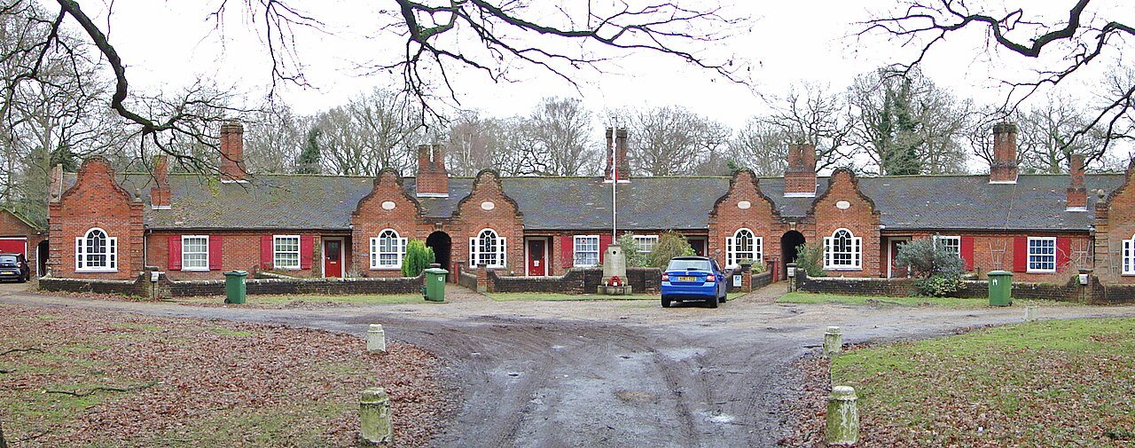
Sprowston is the largest parish in Broadland. The 2021 Census counted 17,126 residents, up from 14,691 in 2011, and the building since then has mostly gone on at the northern edge. The old village centre is around the church of St Mary and St Margaret; the rest is 20th-century estates, the newer streets east of Blue Boar Lane at White House Farm, and two retail parks. There is no high street to speak of.
It works as a base for a Norwich working life. A supermarket, a GP, a secondary school and a frequent bus into the city are all inside the parish. Anything more than that, from a restaurant to a department store, means going into Norwich.
House prices
HM Land Registry recorded 200 standard sales in the NR7 8 postcode sector, which covers most of Sprowston, in the 12 months to June 2026. The median was £280,000 and the mean £282,310. Semi-detached houses made up nearly half of those sales (97), with a median of exactly £280,000.
That puts Sprowston level with its neighbour. Semis in Thorpe St Andrew (NR7 0) had a median of £282,250 over the same period. Cringleford, on the south-west side of the city, is dearer: its semis had a median of £317,500, though from only 18 sales.
| Property type | Sprowston, NR7 8 (median, 12 months to June 2026) | Broadland district (UK HPI, July 2026) |
|---|---|---|
| Terraced | £235,500 (33 sales) | £226,397 |
| Semi-detached | £280,000 (97 sales) | £274,748 |
| Detached | £343,750 (52 sales) | £421,798 |
| Flat or maisonette | £170,000 (18 sales) | £145,444 |
Detached houses are where Sprowston sits well below the district. Most here are on suburban plots, while the Broadland figure also counts village and farm houses. For the district as a whole, the UK House Price Index put the average at £313,407 in July 2026, up 2.9% on a year earlier and 0.2% on the month. The index is adjusted for the mix of homes sold, so it will not match the simple Sprowston medians. The latest months are still being registered, so the sales counts will rise.
Thinking about moving to Sprowston?
Get the free Norfolk Relocation Pack: Sprowston and the other 45 towns we cover on one table, on price, council tax, population, trains and distance to Norwich, plus a week-by-week move checklist. The download appears here as soon as you enter your email.
Unsubscribe any time.
Schools
Sprowston Community Academy, on Cannerby Lane, is an 11 to 18 school with a sixth form, run by the Broad Horizons Education Trust. It is close to full, with 1,702 pupils against a capacity of 1,767 on the Department for Education register. Ofsted inspected it on 6 May 2026 under the new report-card system, which gives no single overall grade, and published the report on 1 July 2026. All seven areas, from achievement to the sixth form, were judged at the expected standard, and safeguarding was met. The report says GCSE results are broadly in line with national averages and improving, vocational sixth-form courses do well above average and A-level results are below it, with small groups taking them.
Sprowston Infant School (ages 4 to 7) and Sprowston Junior School (7 to 11) share a site on Recreation Ground Road. The infant school was judged Good at its graded inspection on 12 February 2020; a further inspection on 13 May 2025 (report published 24 June 2025) did not change that. The junior school was rated Good on 20 June 2023, with the report published on 15 September 2023. They are not the only primaries the academy draws from: Old Catton Church of England Junior and other schools across the NR6 and NR7 postcodes send pupils there too.
A child can go from reception to A levels without leaving the parish. Our Norfolk schools guide explains admissions.
Getting around
The bus is a practical option here. First’s Pink Line 11 and 12 both run along Wroxham Road past Tesco, Cannerby Lane and the police station, each about every half hour through the day, so together there is a bus roughly every 15 minutes. From the stop by Blue Boar Tesco to Castle Meadow takes about 25 minutes. The 12 goes on to the Norfolk and Norwich University Hospital; the 11 goes to the hospital and then Hethersett. Sprowston Park and Ride, on the same route, is the other way in.
Other services: First’s Orange Line 20 (hospital to Old Catton) and the 31, Central Connect routes 2A, 5, 10 and 10A, and the Sanders 54 and 55B/X55 to Coltishall and North Walsham. School buses 853 and 855 go to Broadland High School in Hoveton.
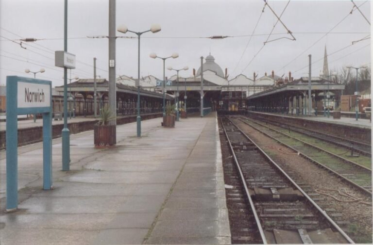
By car, Norwich city centre is 10 to 15 minutes off-peak via Wroxham Road and longer in the morning peak. The Broadland Northway, opened in 2018, runs along the northern edge and takes you to the A47, the airport and the west of the city without crossing the centre. Norwich station is 15 to 20 minutes by car, with trains to London Liverpool Street, the fastest in 1 hour 39 minutes and most in about 1 hour 50. The nearest station on the Bittern Line is Salhouse, about 5 miles out. Cycling into the centre is a flat 3 to 4 miles.
Council tax
A Band D home in Sprowston pays £2,466.51 for 2026-27. The bill is made up of Norfolk County Council, the Norfolk Police and Crime Commissioner, Broadland District Council and Sprowston Town Council. A Broadland parish with no precept pays £2,323.08 at Band D, so the town council’s share is £143.43 a year.
The other bands are A £1,644.34, B £1,918.40, C £2,192.46, E £3,014.63, F £3,562.74, G £4,110.86 and H £4,933.03. Our Norfolk council tax guide compares the districts.
Broadband
We do not have a Sprowston-only figure. Across Broadland, thinkbroadband’s September 2026 data shows 98% of premises can get superfast broadband of 30 Mbps or more, 87.6% can get gigabit speeds and 84.39% can get full fibre. Check the exact address on Ofcom’s checker before you buy, and see our Norfolk broadband guide.
Shops, doctors and open space
The weekly shop is on Blue Boar Lane, where Tesco Extra and Lidl sit next to each other. There is an Aldi at 463 Sprowston Road, on the way into the city.
The main GP practice is the East Norwich Medical Partnership at the Sprowston Primary Care Centre on Aslake Close, with a second surgery at the Thorpe Health Centre. Old Catton Medical Practice covers the western side. The Norfolk and Norwich University Hospital, which has the nearest A&E, is about 20 minutes by car and on the Pink Line 12 bus.
Mousehold Heath, 184 acres of heath and woodland run by the Mousehold Heath Conservators, lies between Sprowston and the city centre. Sprowston Manor on Wroxham Road, a Marriott until Britannia Hotels took it over, has a par-71 golf course and a spa. For theatre, cinema and restaurants you go into Norwich: the Theatre Royal and Cinema City are both in the centre.
Building on the northern edge
Beeston Park is planned at about 3,500 homes, on land that runs from Wroxham Road across North Walsham Road to Buxton Road in Old Catton. Barratt David Wilson Homes is working on Phase 3a, 319 homes, and submitted a reserved matters application for the next stage of infrastructure in July 2025. Separate schemes are under way near White House Farm, east of Blue Boar Lane. If you buy on the northern side, expect construction traffic on Wroxham Road and North Walsham Road for years, and more families applying to the same schools.
Plan the move
How we produced this guide
Sprowston sale prices are HM Land Registry Price Paid Data for standard sales with an NR7 8 postcode in Broadland, 1 July 2025 to 30 June 2026; the Thorpe St Andrew (NR7 0) and Cringleford (NR4 7) comparisons use the same method. District prices are from the UK House Price Index, July 2026 release. Population is from the 2021 Census. School details are from Ofsted reports (URNs 144359, 120853 and 120852) and the Department for Education register. Bus times are from the timetables on bustimes.org, checked on 25 September 2026. Council tax is from Broadland District Council’s 2026-27 charges. Broadband figures are from thinkbroadband. Drive times are typical times on the main roads. We update this guide quarterly. Last reviewed 25 September 2026. See our methodology page for source links.
Frequently asked questions
Is Sprowston a nice place to live?
For families who work in Norwich, yes: there is a secondary with a sixth form, a bus into the city about every 15 minutes and semis at around £280,000. It is suburban, with no town centre and no railway station.
What is the average house price in Sprowston?
The median of the 200 standard sales in the NR7 8 postcode sector in the 12 months to June 2026 was £280,000. Terraced houses had a median of £235,500 and detached houses £343,750.
Which bus goes from Sprowston to Norwich?
First’s Pink Line 11 and 12 run along Wroxham Road into the city centre, together about every 15 minutes in the daytime, and take about 25 minutes to Castle Meadow. Central Connect 2A, 5, 10 and 10A, First’s 20 and 31, and the Sanders 54 and 55B/X55 also serve Sprowston.
Is there a train station in Sprowston?
No. Norwich station, for London Liverpool Street, is 15 to 20 minutes by car. Salhouse, on the Bittern Line, is about 5 miles away.
What are the schools like in Sprowston?
Sprowston Community Academy (11 to 18) was judged at the expected standard in all areas at its Ofsted inspection on 6 May 2026. Sprowston Infant School and Sprowston Junior School, on Recreation Ground Road, are both rated Good.
How does Sprowston compare with Thorpe St Andrew and Hellesdon?
Semis cost about the same in Sprowston and Thorpe St Andrew: medians of £280,000 and £282,250 in the year to June 2026. Thorpe has the river and is closer to the Broads; Hellesdon is on the airport side of the city. Our Sprowston vs Thorpe St Andrew page compares the first two in detail.
What is council tax in Sprowston?
£2,466.51 at Band D for 2026-27, of which £143.43 is the Sprowston Town Council precept. Band A is £1,644.34 and Band C £2,192.46.
Related guides
Data sources: HM Land Registry, ONS, Ofsted, Broadland District Council, bustimes.org, thinkbroadband. Sale prices to June 2026; UK HPI July 2026 release; Ofsted inspections 2020 to 2026. Last reviewed 25 September 2026. Author: James Ward, Norwich Suburbs and Schools Editor.
Last reviewed
Still weighing it up? See how Sprowston compares with Thorpe St Andrew on prices, schools, broadband and council tax, or answer five quick questions and get a shortlist of the Norfolk towns that fit you.
Planning a move to Norfolk?
Our guides to hiring the firms a move needs.
We earn no commission on these links. Paid placements are sold separately and always labelled. See our advertising and disclosure page.